Bornholm · Denmark · Reef
Hammeren
Granite that runs on underwater, dived as a coastal circuit
Photo: Ein Dahmer · CC BY-SA 4.0
Hammerknuden is the 182-hectare granite dome on the northern tip of Bornholm, and the rock does not stop at the waterline. VisitBornholm lists a tour of its coast at a maximum of 14 m, the deepest of the sites clustered on this end of the island. The headland above is heather, grass and forest, and it is protected as Natura 2000 site no. 184, Hammeren og Slotslyngen.
Also known as Hammerknuden.
Where it is and how deep
55.2961° N, 14.7764° EApproximate position — the dashed circle shows where the site lies; your operator's briefing has the mooring.
The dive
The route is the coast of Hammerknuden itself, taken as a tour around the headland, and VisitBornholm gives 14 m as the maximum on it. The ground is granite, the same rounded rock that forms the 182 hectares of heather and forest above the waterline, so you are following a rock coast rather than a seabed and reading the shape of the headland from below.
Which stretch you dive is a wind decision. VisitBornholm warns of potentially strong underwater currents under certain wind conditions, and the exposure changes as you work around the point, so take the side that is in the lee and cover one leg of the coast rather than committing to the full circuit in a single dive. The walking paths across the headland give you the overland view of the same coastline afterwards.
Marine life and season
The sources we used don't single out particular species here.
| Jan | Feb | Mar | Apr | May | Jun | Jul | Aug | Sep | Oct | Nov | Dec |
|---|---|---|---|---|---|---|---|---|---|---|---|
| Fair | Fair | Fair | Good | Good | Prime | Prime | Prime | Prime | Good | Fair | Fair |
Season follows Bornholm: Jun–Sep is warmest and calmest; late winter gives the clearest water, and the Baltic can ice over in hard years.
Know before you go
- Underwater currents can run strong under certain wind conditions: check the forecast before entering and plan the leg so the return swim is not against the flow.
Photos from Hammeren
Hubertus · CC BY-SA 3.0
Unukorno · CC BY 4.0
Detlef Hansen · CC BY-SA 4.0
Dive videos
Bornholm Dyk Foråret 2022 · Martin Albeck on YouTube
Questions divers ask
How deep is diving at Hammeren?+
VisitBornholm lists the coastal tour around Hammerknuden at a maximum of 14 m, which keeps it within Open Water limits. The cold and the drysuit are a bigger constraint on the dive than the depth is.
Is Hammeren a protected area?+
Yes. Hammerknuden is Natura 2000 site no. 184, Hammeren og Slotslyngen — a 182-hectare granite headland of heather, grass and forest on the northern tip of Bornholm.
Sources
- Hammeren (Hammerknuden) — Wikipedia (da)
- Diving on Bornholm: discover Denmark's underwater wonders — VisitBornholm
Photo credits
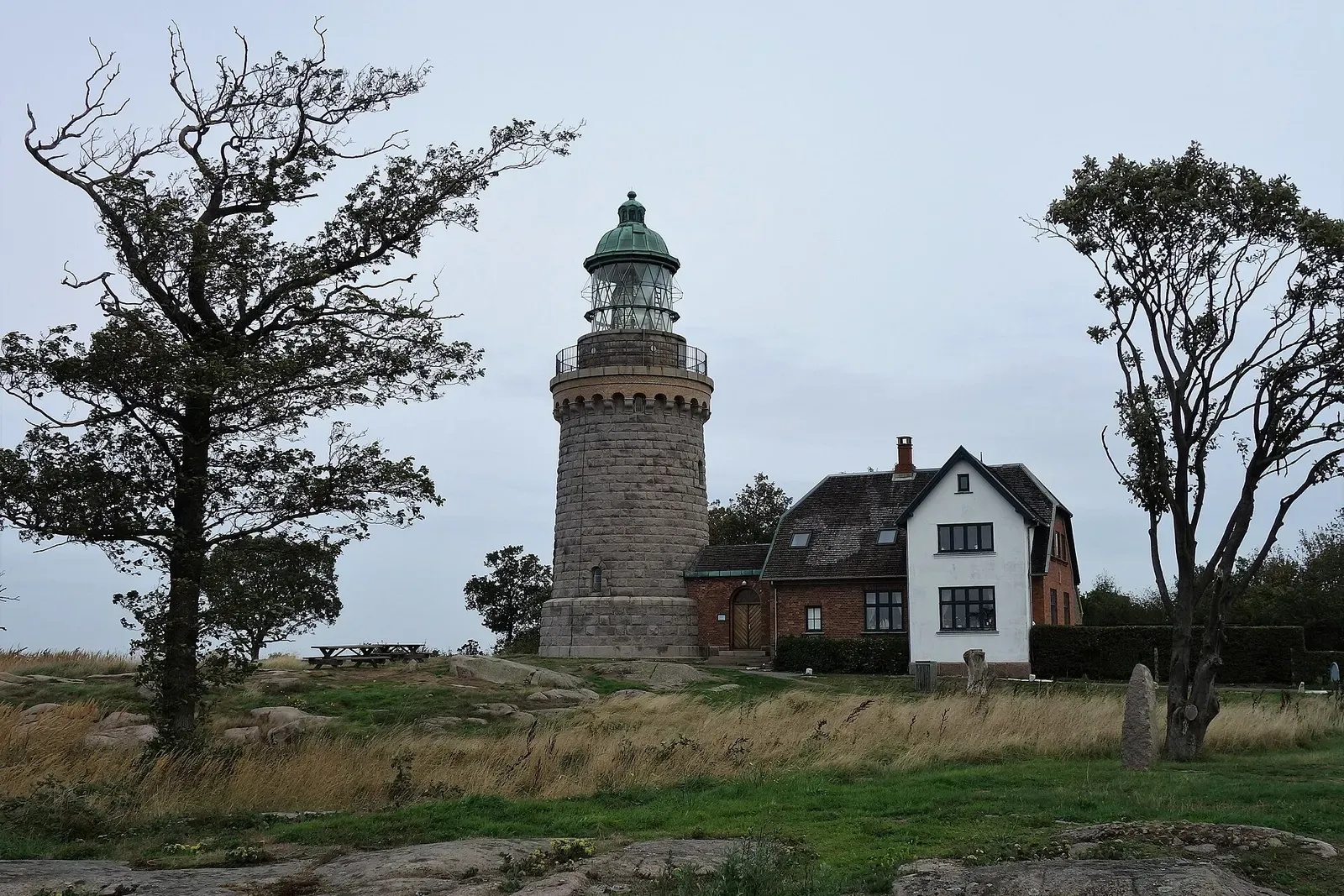
- Hammeren lighthouse rising from Bornholm's northernmost granite plateau, ringed by trees. by Ein Dahmer, CC BY-SA 4.0, via Wikimedia Commons
- Hammerodde Fyr lighthouse and keeper's house on the rocky tip of Hammer Odde. by Hubertus, CC BY-SA 3.0, via Wikimedia Commons
- Hammerodde Fyr with a ship's anchor and radio mast on the headland below. by Unukorno, CC BY 4.0, via Wikimedia Commons
- Heath and gorse covering the exposed granite plateau above Hammeren. by Detlef Hansen, CC BY-SA 4.0, via Wikimedia Commons
In The Logbook
- Cold-water diving: is it worth the drysuit?Cold water · 8 min read
More dive sites in Bornholm
Baltic wall diving to 30 m, with a seal colony on the skerries
Similar dives elsewhere
Reef
Axelsro
Gotland & Fårö · Sweden
The easy-to-reach Visby site of small passages and stone atolls
A shallow training site known for its lobsters
Old diver-training rigs and wreckage scattered around the base of a sea fort


Two rocks at the mouth of Port Quin, diveable at any tide