RMS Rhone & Salt Island · British Virgin Islands · Wreck
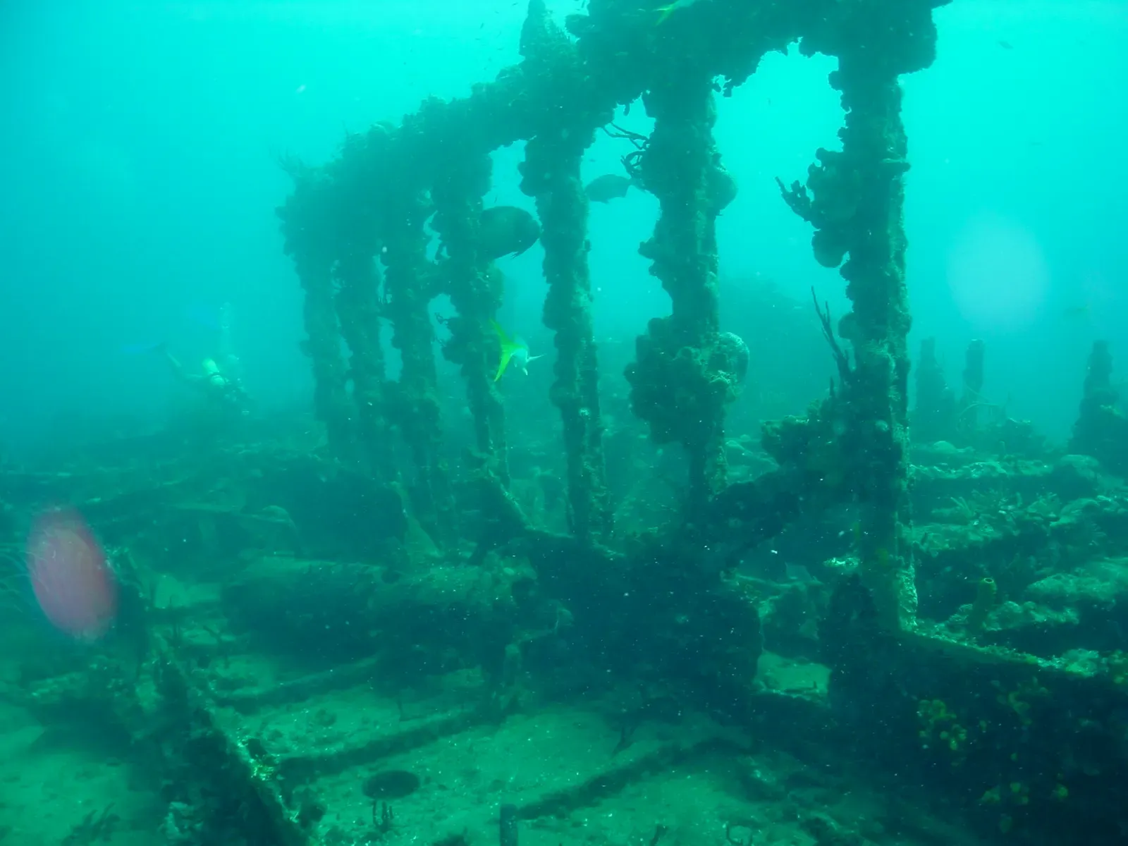
RMS Rhone — bow
The 1867 liner's forward hull, swum at 24 m
Photo: Gareth Richards · CC BY 3.0
The forward half of the RMS Rhone, the passenger liner wrecked off Salt Island in the hurricane of 29 October 1867, lies in 24 m of water with the deepest ground at 26 m. It is the deeper of the two halves of the wreck and is dived from a boat. A green moray and a Goliath grouper frequent this section, and the site has been inside a national park since 1980.
Also known as Rhone bow.
Where it is and how deep
18.3709° N, 64.5343° WApproximate position — the dashed circle shows where the site lies; your operator's briefing has the mooring.
The dive
Boats run the deeper half first. You drop onto the forward section in 24 m, with the deepest ground at 26 m, and work the hull for 25 to 30 minutes — the standard first tank of a two-tank Rhone trip. The variety of artifacts still lying on the wreck after more than 157 years is most of what divers come to look at, and they stay where they are: the site was turned into a national park in 1980.
A green moray and a Goliath grouper both frequent this part of the wreck, and turtles turn up through the dive — they are known to pop up right next to the boat. There is an abundance of fish life over the hull. The second tank of the day starts shallower, at 21 m on the mid-section, so the pair of dives covers different ground rather than repeating the same swim over the bow.
The wreck
- Vessel
- RMS Rhone
- Type
- Passenger liner
- Length
- 94 m (308 ft)
- Built
- 1865
- Sunk
- 1867
- Cause
- Driven back onto Salt Island by the hurricane of 29 October 1867
- Lies
- Forward hull in 24 m off Salt Island, deepest ground at 26 m
The Rhone was launched at the Millwall Iron Works on the Isle of Dogs, London, on 11 February 1865 and wrecked on 29 October 1867, driven back onto Salt Island by a hurricane while attempting to head to safety at sea. Of the approximately 145 crew and passengers aboard, twenty-five survived. The wreck was turned into a national park in 1980, and the 1977 film The Deep shot underwater sequences on it. It is considered one of the premier scuba diving sites in the Caribbean.
Marine life and season
- Groupers
- Sea turtles
- Reef fish swarms
| Jan | Feb | Mar | Apr | May | Jun | Jul | Aug | Sep | Oct | Nov | Dec |
|---|---|---|---|---|---|---|---|---|---|---|---|
| Prime | Prime | Prime | Prime | Good | Good | Good | Fair | Fair | Fair | Good | Prime |
Season follows RMS Rhone & Salt Island: Nov–Jun is calmest and clearest; Aug–Oct hurricane season brings swell that can close the exposed Rhone site entirely.
Know before you go
- The forward section is the deep half of the wreck at 24 m, with 26 m if you drop to the sand: plan the first tank on gas and no-stop time, not on the clock.
Photos from RMS Rhone — bow
Gareth Richards · CC BY-SA 3.0
Dive videos
RMS Rhone (Bow) [+1867], Salt Island 🇻🇬 (#664) · Matthew Brown on YouTube
RMS Rhone bow section swim-thru · taihaku111 on YouTube
Questions divers ask
How deep is the RMS Rhone bow?+
The forward section lies in 24 m of water and the deepest ground around it is 26 m. Operators run it as the first tank of a two-tank day, typically 25 to 30 minutes on the wreck.
What certification do I need for the Rhone bow?+
Operators list the Rhone as beginner to advanced, but the forward section is the deep half. At 24 to 26 m it is an Advanced Open Water profile in practice, and it is dived from a boat.
Is the Rhone wreck protected?+
Yes. The wreck was turned into a national park in 1980, and the variety of artifacts on it is still in place after more than 157 years.
Sources
- RMS Rhone — Wikipedia
- Salt Island, British Virgin Islands — Wikipedia
- RMS Rhone — Dive BVI
- Dive Sites — Sail Caribbean Divers
- Rhone wreck node — OpenStreetMap
Photo credits
- Tall corroded metal rigging and mast structure of the RMS Rhone wreck rising from the seabed by Gareth Richards, CC BY 3.0, via Wikimedia Commons
- Encrusted deck beam and soft corals growing on the wreck's intact bow structure by Gareth Richards, CC BY-SA 3.0, via Wikimedia Commons
More dive sites in RMS Rhone & Salt Island
Coral ridges in north-south lines with sand lanes between
Reef
Sheltered canyons and ridges off the tip of Norman Island
Pinnacle
An amphitheatre of rock, ledges and swim-throughs to 18 m
Overhangs and a gentle slope in 6 to 15 m off Cooper Island
Reef
A rocky islet between Ginger and Cooper, sloping to 30 m
Wreck
A 1988 refrigeration ship at 23 m, a long run offshore
Reef
Pillar and black coral at 21 m with pelagics passing through
Wall
A three-step wall with different growth on every ledge
Similar dives elsewhere

Three sunk ships and a retired underwater habitat in one bay
Wreck
Christena Wreck
Nevis · Saint Kitts and Nevis
An upright 49 m ferry hull dressed in soft corals and crinoids


A 1986 artificial-reef freighter lying in 20 m of bay
Wreck
River Taw
St. Kitts · Saint Kitts and Nevis
An upright freighter crusted in corals and sponges