Svalbard · Norway · Ice
Smeerenburgfjorden
A glacier front at the head of a north-west Spitsbergen fjord
Photo: Bjoertvedt · CC BY-SA 3.0
Smeerenburgfjorden is a fjord in Albert I Land, north-west Spitsbergen, with the Smeerenburgbreen glacier at its head and the site of the 17th-century Dutch whaling station Smeerenburg at its mouth. No dive site is named here and no route or entry point is published for the fjord: it is tender work among the ice the glacier sheds, decided by the ship on the day.
Where it is and how deep
79.6642° N, 11.1736° EApproximate position — the dashed circle shows where the site lies; your operator's briefing has the mooring.
The dive
Smeerenburgfjorden runs about 20 kilometres inland and is about 4 kilometres wide, set between the peninsulas of Vasahalvøya and Reuschhalvøya, and it opens westwards to the sea through the straits of Danskegattet and Sørgattet. That is the way a ship comes in, and everything here is done from the vessel and its tenders: there is no road, no shore base and no published entry point anywhere on the fjord.
The Smeerenburgbreen glacier debouches into the head of the fjord, and the inner end is what a dive ship comes for — ice the glacier has shed, worked well clear of any active calving face. No published source names a dive site or a route in this water, and the ships that work it dive to around 20 metres at most, so what gets dived on the day is the ship's call, made from the ice and the weather rather than from a site plan.
Background
The fjord is named after Smeerenburg, the Dutch whaling settlement of the 17th century that stood on the southern part of Amsterdam Island, at the mouth of the fjord. The station is long gone and the name stayed on the water. The ground it worked is now simply the western approach: the way a ship enters from the sea through Danskegattet and Sørgattet to reach the glacier at the fjord's head.
Marine life and season
The sources we used don't single out particular species here.
| Jan | Feb | Mar | Apr | May | Jun | Jul | Aug | Sep | Oct | Nov | Dec |
|---|---|---|---|---|---|---|---|---|---|---|---|
| Off-season | Off-season | Off-season | Off-season | Fair | Prime | Prime | Prime | Good | Off-season | Off-season | Off-season |
Season follows Svalbard: Expedition ships operate Jun–Sep in the polar summer; outside that window the archipelago is dark, iced in and inaccessible.
Know before you go
- A glacier front is dived well clear of any active calving face, among grounded and drifting blocks rather than under one; the ship sets the standoff, not the group.
- Outside the settlements a rifle must be carried for polar bear protection, so tender landings and shore work run with the ship's armed guide.
Photos from Smeerenburgfjorden
Bjoertvedt · CC BY-SA 3.0
Bjoertvedt · CC BY-SA 3.0
Bjoertvedt · CC BY-SA 3.0
Questions divers ask
What is there to dive in Smeerenburgfjorden?+
The Smeerenburgbreen glacier debouches into the head of the fjord and the diving is done among the ice it sheds, well clear of any active calving face. No published source names a route or an entry point here; polar dives run to a maximum of around 20 metres, and the rest is decided by the ship from the ice and the weather.
Where does the name Smeerenburgfjorden come from?+
From Smeerenburg, the 17th-century Dutch whaling settlement that stood on the southern part of Amsterdam Island, at the mouth of the fjord.
Sources
- Smeerenburgfjorden — Wikipedia
- Polar diving — Oceanwide Expeditions
- Diving in Spitsbergen — Oceanwide Expeditions
- Svalbard — Wikivoyage
Photo credits
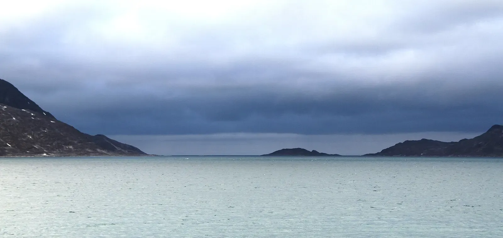
- Low islands and distant peaks silhouetted across the water of Smeerenburgfjorden, seen from Moseøya. by Bjoertvedt, CC BY-SA 3.0, via Wikimedia Commons
- Dark mountain ridge above the grey water of Smeerenburgfjorden, seen from Danskøya to the southeast. by Bjoertvedt, CC BY-SA 3.0, via Wikimedia Commons
- Overcast view of Danskøya's coastline from the south, at the mouth of Smeerenburgfjorden. by Bjoertvedt, CC BY-SA 3.0, via Wikimedia Commons
- Cloud-wrapped mountains along the shore of Smeerenburgfjorden, viewed from southwest Moseøya. by Bjoertvedt, CC BY-SA 3.0, via Wikimedia Commons
In The Logbook
- Ice diving: how it works and where to goCold water · 12 min read
- Cold-water diving: is it worth the drysuit?Cold water · 8 min read
More dive sites in Svalbard
Bays here only appeared as the glaciers pulled back
Two glaciers head this 26 km fjord off Ny-Ålesund
A documented walrus haul-out inside a national park
Similar dives elsewhere
A nerpa pup swimming alongside divers at a seal hole in the ice
A tidal current keeps this glacier-backed bay ice-free
Ice
Biofilter Bay
White Sea · Russia
Ice hummocks under a cliff shaped like a mammoth


Sea angels drifting over a kelp forest