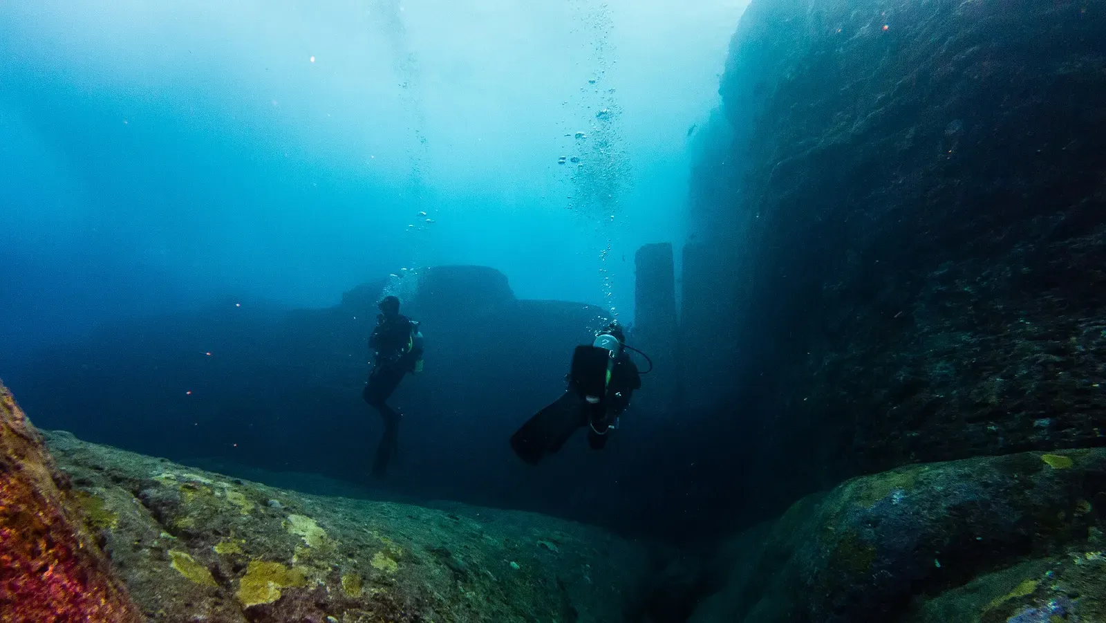
Yonaguni · Japan · Pinnacle
Yonaguni Monument
Right-angled terraces and a 2 m tunnel in 5 to 20 metres
The Yonaguni Monument is a terraced rock platform off the southern coast of Japan's westernmost island, roughly 100 by 50 metres and standing up to 25 metres tall, lying in 5 to 20 metres of water. Right-angled steps, ledges and a narrow tunnel run through it, and divers end up arguing the same question scientists do: natural fracture, or human hand.
Also known as Yonaguni Submarine Ruins, Underwater Landscape Resources.
Where it is and how deep
24.4358° N, 123.0114° EPublished position for this site.
The dive
Boats leave Kubura and reach the site in about 20 minutes, and they only go when the formation sits on the leeward side of a north wind and the current has eased — the area is notorious for its currents, so a booked day can be called off at the harbour. Descend onto the platform and the scale registers first: a single mass roughly 100 metres long and 50 wide, standing up to 25 metres tall, with the shallowest steps at around 5 metres, the ruins running down to 20 and the foot of the formation at 26.
Orientation runs on names the original discoverers and researchers gave the features. They may not be scientifically correct, but no better names exist and they work underwater. The Main Terrace and its stairs form the core of the circuit; the Loop Road, a ledge 5 metres wide, encircles the base of the formation on three sides and gives you a line to follow when the flow picks up. The Twin Megaliths, Water Trench, Triangle Pool and Turtle Monument sit off that route.
The Arch Gate is the one squeeze on the dive, a passage 1 metre wide and 2 metres high that reads like a short tunnel; take it one at a time with nothing trailing. Work back up the terraces to finish at around 5 metres, where the light shows the right-angled edges best — and where the water is busiest, since the island lies in open sea with no protective reef to break the swell before it reaches the shallow steps.
Background
The formation's origin has been argued over since it became a diving attraction. Some date it to around 8,000 years old and hold that the technology needed to build it here matches no known timeline of human history, with fringe claims tying it to the lost continent of Mu or to alien artifacts; the majority of scientists think it was created by natural geological processes. The Japanese government stays out of the argument, referring to the formation dryly as the "Underwater Landscape Resources" lying off the island's southern coast.
Marine life and season
The sources we used don't single out particular species here.
| Jan | Feb | Mar | Apr | May | Jun | Jul | Aug | Sep | Oct | Nov | Dec |
|---|---|---|---|---|---|---|---|---|---|---|---|
| Prime | Prime | Prime | Good | Good | Good | Fair | Fair | Fair | Good | Good | Prime |
Season follows Yonaguni: Hammerhead season peaks December to March; summer brings typhoon risk and rougher currents.
Know before you go
- The area is notorious for its currents. Trips run only when the site is leeward of a north wind and the flow has dropped, so build spare days into the trip.
- The Arch Gate passage is only 1 metre wide and 2 metres high — enter one diver at a time, with no trailing gear or dangling gauges.
- The shallowest terraces sit at about 5 metres and the island has no protective reef, so swell reaches them; hold trim and distance off the rock rather than finning against the water.
Photos from Yonaguni Monument
Vincent Lou from Shanghai, China · CC BY 2.0
Vincent Lou from Shanghai, China · CC BY 2.0
Vincent Lou from Shanghai, China · CC BY 2.0
Dive videos
Entrance to the Yonaguni Monument · ScubaNick on YouTube
The Yonaguni Monument & Hammerhead Sharks Diving 4K · moet.mp4 on YouTube
Questions divers ask
How deep is the Yonaguni Monument?+
The ruins lie in 5 to 20 metres of water, with the site's deepest point at 26 metres. The platform itself measures roughly 100 by 50 metres and stands up to 25 metres tall, so one dive can take in the upper terraces and the base without going deep.
What certification do I need to dive it?+
PADI Advanced Open Water or higher: the area is notorious for its currents and is not suitable for beginning divers. Several dive shops run one-day crash courses that culminate in a guided tour of the ruins. A day's diving starts at ¥12,000.
Can I see the Monument without diving?+
Wind conditions permitting, SOUWES Diving Service arranges glass-bottomed boat trips over the site for ¥5,000 per person when there are five or more passengers, or you can charter the whole boat yourself.
Sources
- Yonaguni Monument — Wikipedia
- Yonaguni — Wikivoyage
Photo credits
- Two scuba divers hover beside the massive stepped stone terraces of Yonaguni Monument underwater. by Vincent Lou from Shanghai, China, CC BY 2.0, via Wikimedia Commons
- A diver swims along a sheer underwater rock wall at Yonaguni Monument, trailing bubbles. by Vincent Lou from Shanghai, China, CC BY 2.0, via Wikimedia Commons
- Divers hover over angular submerged rock terraces at the Yonaguni Monument dive site. by Vincent Lou from Shanghai, China, CC BY 2.0, via Wikimedia Commons
- A diver explores a narrow, coral-encrusted crevice within the Yonaguni Monument rock formation. by Vincent Lou from Shanghai, China, CC BY 2.0, via Wikimedia Commons
In The Logbook
- Where to dive in DecemberTrip planning · 10 min read
- What is surge in diving, and how deep it goesOcean science · 8 min read
Similar dives elsewhere

.jpg)
.jpg)
.jpg)
.jpg)
A seamount 2 km offshore, dived at slack water for pelagics
Pinnacle
Isomura
Katsuura & Namegawa · Japan
Houndsharks resting in a cave at the tip of the south reef
Pinnacle
Ogan
Iriomote & the Yonara Channel · Japan
The Eastern Root, huge hidden roots rising from the seafloor
Pinnacle
Ootaka-ne
Miura Peninsula · Japan
Soft corals blanketing the walls of the northern drop-off