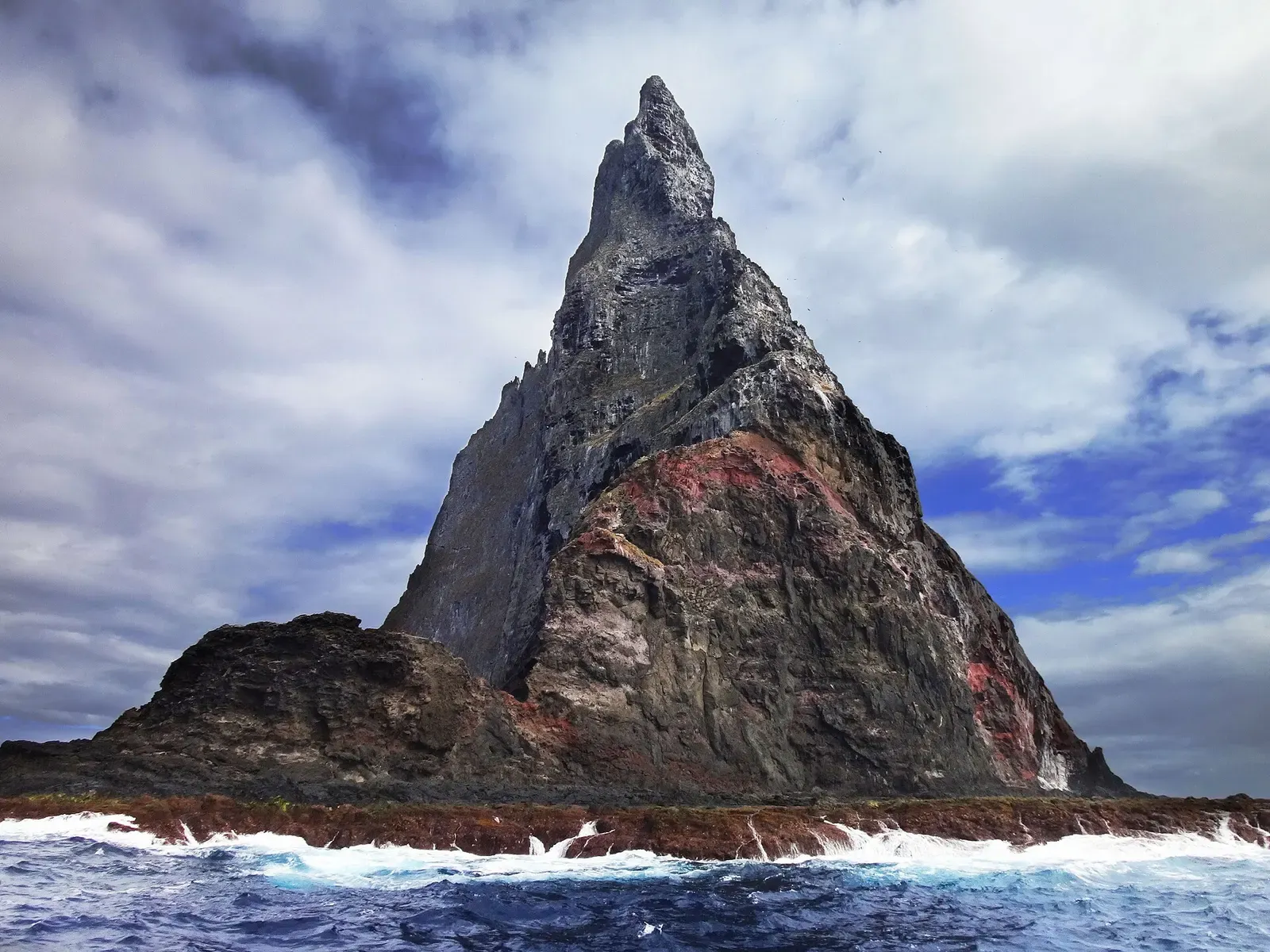
Lord Howe Island · Australia · Pinnacle
Balls Pyramid
A stack in open ocean, reached only when the sea allows
Photo: PotMart186 · CC BY-SA 4.0
Balls Pyramid is a basalt stack standing alone in open ocean southeast of Lord Howe Island, in the centre of a submarine shelf that lies under about 50 metres of water. Diving it means an exposed crossing from the island and then rock rather than reef: large boulders, rock piles, peaks, caves and crevices. The Ballina angelfish is relatively common here.
Also known as Ball's Pyramid.
Where it is and how deep
31.7542° S, 159.2517° EPublished position for this site.
The dive
The dive begins with the crossing. Balls Pyramid stands alone southeast of Lord Howe Island, in the centre of a submarine shelf that runs 20 kilometres long and averages 10 kilometres wide under about 50 metres of water, cut off from the island by a 500-metre-deep canyon. Nothing shelters it: the shelf is surrounded by rough seas, any approach is difficult, and trips go on the days the sea allows rather than to a schedule.
Underwater it is rock rather than reef. The stack is basalt and the ground around it is large boulders, rock piles, peaks, caves and crevices, with deep water on every side and the shelf floor about 50 metres down. That is the habitat of the Ballina angelfish, a subtropical species living between 15 and 120 metres and relatively common here, so the dive is a slow read of the rock rather than a run along a reef.
Background
Balls Pyramid rises from a submarine shelf southeast of Lord Howe Island, and above water it has been closed to visitors for decades. Climbing was prohibited in 1982 and all access banned by 1986; the policy was partially relaxed in 1990 to allow climbing under strict conditions, which today require ministerial approval. The water around it lies inside the Lord Howe Island Marine Park's protected three-nautical-mile zone, and the diving happens entirely below the line that ban draws.
Marine life and season
The sources we used don't single out particular species here.
| Jan | Feb | Mar | Apr | May | Jun | Jul | Aug | Sep | Oct | Nov | Dec |
|---|---|---|---|---|---|---|---|---|---|---|---|
| Prime | Prime | Prime | Prime | Good | Good | Fair | Fair | Good | Good | Good | Prime |
Season follows Lord Howe Island: The warm East Australian Current peaks Dec–Apr for the calmest, clearest diving; winter (Jul–Aug) is cooler with more boat-canceling swell.
Know before you go
- The shelf the stack sits on is surrounded by rough seas and any approach is difficult; trips run only on the days the sea allows, not to a fixed schedule.
- There is no decompression chamber on Lord Howe Island and the Pyramid is an open-ocean run from it: keep the profile conservative and well inside no-decompression limits.
Photos from Balls Pyramid
patrickkavanagh · CC BY 2.0
Fanny Schertzer · CC BY-SA 4.0
Graham Edgar / Reef Life Survey · CC BY 3.0
Dive videos
Diving Ball's Pyramid · Thornleigh Farm on YouTube
Questions divers ask
Can you dive Balls Pyramid?+
Yes. Several Lord Howe Island operators run boat trips out to it, southeast of the island across a 500-metre-deep submarine canyon. The trip goes only when the sea allows: the shelf the stack stands on is surrounded by rough water, which makes any approach difficult.
Sources
- Ball's Pyramid — Wikipedia
- Lord Howe Island — Wikivoyage
- Ball's Pyramid (OpenStreetMap node) — OpenStreetMap
Photo credits
- Ball's Pyramid rising sheer from the sea, waves breaking at its base by PotMart186, CC BY-SA 4.0, via Wikimedia Commons
- Twin-peaked Ball's Pyramid seen from a boat, wake trailing in the foreground by patrickkavanagh, CC BY 2.0, via Wikimedia Commons
- Ball's Pyramid's jagged summit ridge in warm afternoon light by Fanny Schertzer, CC BY-SA 4.0, via Wikimedia Commons
- Yellowbanded wirrah resting on a rocky reef ledge by Graham Edgar / Reef Life Survey, CC BY 3.0, via Wikimedia Commons
In The Logbook
- Where to dive in DecemberTrip planning · 10 min read
More dive sites in Lord Howe Island
Black coral and gorgonia on the walls of an offshore Admiralty Group outcrop
Similar dives elsewhere

A manta cleaning station beside a coral-covered Admiralty anchor

A 200 m rock circled in one dive, 18 m sand to 12 m top

.jpg)


Deep sponge reef and fur seals on Tasmania's hardest pinnacle
The island's main manta cleaning station, in 14 m of water