Banyuls-sur-Mer & the Côte Vermeille · France · Reef · Wall
Cap Béar
The sheltered fallback dive when the Tramontane blows
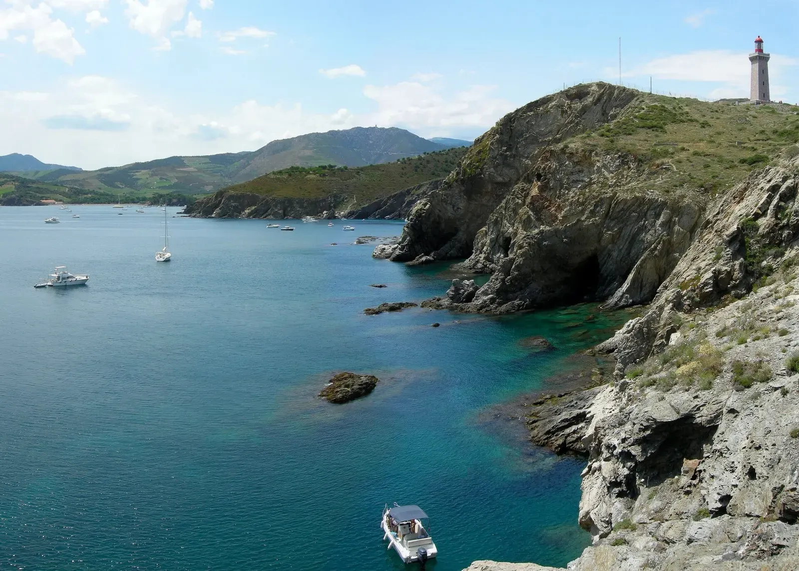
Photo: Tobi 87 · CC BY-SA 4.0
The headland dive the boats fall back on when the Tramontane blows: Cap Béar is sheltered from the wind, and its bottom of small drop-offs, faults and coralligenous heads runs from 5 to 26 m. It is an easy, unhurried dive over rock with seabream, damselfish, wrasse and moray eels, and lobsters and nudibranchs in the cracks.
Where it is and how deep
42.5156° N, 3.1413° EPublished position for this site.
The dive
You drop in close under the cape onto rock at about 5 m and head out over a bottom that is never flat: small drop-offs, faults and rounded coralligenous heads, the 'patates', follow one another down to 26 m. There is no single wall to follow, so the dive is a walk from head to head, using each little drop-off as a step down and each fault as something to look into.
The open rock carries the fish: seabream, damselfish and wrasses over the heads, with moray eels in the holes between them. The faults are where you slow down for the small stuff, lobsters tucked back under the overhangs and nudibranchs on the coralligenous crust. The return is the same ground in reverse, climbing back through the drop-offs toward the cape and finishing in the shallow rock near 5 m for the stop.
Marine life and season
- Nudibranchs
- Macro critters
| Jan | Feb | Mar | Apr | May | Jun | Jul | Aug | Sep | Oct | Nov | Dec |
|---|---|---|---|---|---|---|---|---|---|---|---|
| Fair | Fair | Fair | Fair | Good | Prime | Prime | Prime | Prime | Good | Fair | Fair |
Season follows Banyuls-sur-Mer & the Côte Vermeille: The Banyuls centres open year-round, but the sea averages 12 °C in February against 23 °C in August, the reserve's snorkel trail runs June to September, and the Tramontane can stop boats in any month.
Photos from Cap Béar
Artico2 · CC BY-SA 3.0
Questions divers ask
How deep is Cap Béar?+
The bottom runs from 5 to 26 m, made up of small drop-offs, faults and coralligenous heads rather than one wall.
When is Cap Béar dived?+
Most often when the Tramontane is blowing: the cape is sheltered from the wind, so it is a site the centres can still dive in strong winds.
Sources
- Cap Béar - Scubago — Scubago
- Cap Béar — Wikipédia
- Cap Béar - OpenStreetMap — OpenStreetMap
Photo credits
- Turquoise cove and rocky headland at Cap Béar with a dive boat anchored offshore by Tobi 87, CC BY-SA 4.0, via Wikimedia Commons
- Cap Béar lighthouse on its rocky headland seen from the sea by Artico2, CC BY-SA 3.0, via Wikimedia Commons
More dive sites in Banyuls-sur-Mer & the Côte Vermeille
A 95 m WWII escort cut in two by a torpedo, mast top at 25 m, bow at 50 m
White gorgonians, nudibranchs and lobsters in the faults at 18 to 20 m
Reef
Faults and small caves between 5 and 30 m, with groupers and congers in the holes
Reef
Beach entry into a marine reserve, with a signposted underwater trail
Wreck
Broken collier at 44 m; follow the wreckage to a bow with its anchors still in place
Wreck
A 99 m collier on her keel at 45 m, stern broken off, emergency propeller still visible
Wall
Drop-offs, rocks and caves between 15 and 30 m off Banyuls
Reef
Groupers, dentex, brown meagre and barracuda in 5 to 20 m of reserve water
Similar dives elsewhere

A drop-off from about 10 m to 33 m, then a seagrass bed

Circle the reef from 18 to 32 m, with the Phedon's remains on it


A cove sheltered from wind and swell, 10 m to 30 m
Canyons, rifts and drop-offs between 10 and 30 m