
Australia & New Zealand · New Zealand
Poor Knights Islands
Massive fish schools swirl through archways at one of the world's largest sea caves.
Photo: Anna Barnett · CC BY 2.0
The Poor Knights Islands are volcanic remnants 23 kilometers off Tutukaka in Northland, protected as a no-take marine reserve since 1981. The warm East Auckland Current sweeps subtropical fish species south to mix with temperate residents, producing dense schools of blue maomao and demoiselles around dramatic archways, and Rikoriko Cave, one of the world's largest sea caves, is large enough to dive inside by boat.
About diving in Poor Knights Islands
Every dive is a day-boat dive. Charters leave Tutukaka marina in the morning, cross to the islands in under an hour, and fit two dives around a surface interval spent anchored in a bay. Nobody goes ashore: the islands are a nature reserve and landing needs a permit recreational visitors do not get, so the boat is your only platform for the day. Skippers pick sites off the morning's wind and swell, and with so many bays and faces to choose from there is usually a sheltered option somewhere.
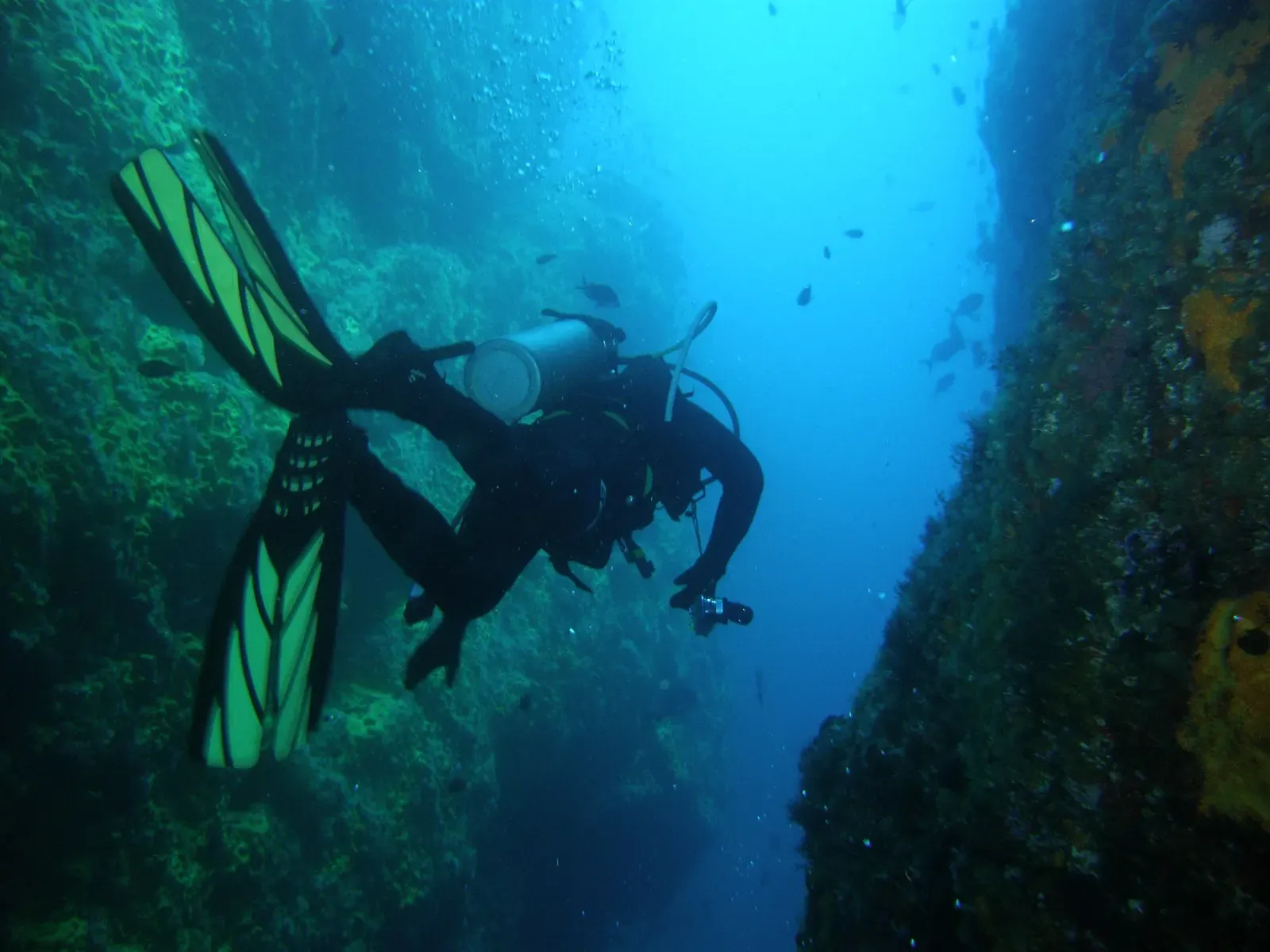
The islands drop straight into deep water rather than shelving off, so the diving happens close against vertical rock. What makes the terrain unusual is how comprehensively it is drilled through, with tunnels and archways piercing whole headlands and caves running back into the cliffs, at least one of them holding an air-filled chamber above the waterline. Kelp covers the shallow rock, sponge and gorgonian growth takes over further down, and there is no reef-building coral in any of it.
Fish density is the reason divers come back. In the gaps the schools stack up densely enough to close off the view of the far wall, and decades of protection have left the resident fish large and largely indifferent to divers. Conditions vary more than the photographs suggest: current runs hardest through exactly the gaps where the fish sit, surge inside the arches can push you around on a swelly day, and visibility can swing widely within a single dive as the current turns.
Trips tend to be short, since everything runs on the boat's schedule and two or three days covers the well-known sites without repeating them. Two decommissioned navy vessels were scuttled closer inshore off Tutukaka around the turn of the 2000s and are dived on separate charters, which is a useful fallback when swell shuts the outer islands down, though one of the two has broken up substantially in the storms since.
Best time to dive Poor Knights Islands
| Jan | Feb | Mar | Apr | May | Jun | Jul | Aug | Sep | Oct | Nov | Dec | |
|---|---|---|---|---|---|---|---|---|---|---|---|---|
| Season | Prime | Prime | Prime | Prime | Good | Good | Fair | Fair | Fair | Good | Good | Good |
| Sea surface | 20°C68°F | 21°C70°F | 21°C70°F | 20°C68°F | 19°C66°F | 18°C64°F | 16°C61°F | 16°C61°F | 16°C61°F | 16°C61°F | 17°C63°F | 19°C66°F |
| Daytime high | 23°C73°F | 24°C75°F | 23°C73°F | 22°C72°F | 20°C68°F | 19°C66°F | 17°C63°F | 17°C63°F | 17°C63°F | 19°C66°F | 20°C68°F | 22°C72°F |
| Rain | 87 mm3.4 in | 69 mm2.7 in | 88 mm3.5 in | 105 mm4.1 in | 123 mm4.8 in | 139 mm5.5 in | 144 mm5.7 in | 126 mm5.0 in | 118 mm4.6 in | 83 mm3.3 in | 84 mm3.3 in | 83 mm3.3 in |
| Jan | Feb | Mar | Apr | May | Jun |
|---|---|---|---|---|---|
| Prime | Prime | Prime | Prime | Good | Good |
| Sea surface | |||||
| 20°C68°F | 21°C70°F | 21°C70°F | 20°C68°F | 19°C66°F | 18°C64°F |
| Daytime high | |||||
| 23°C73°F | 24°C75°F | 23°C73°F | 22°C72°F | 20°C68°F | 19°C66°F |
| Rain | |||||
| 87 mm3.4 in | 69 mm2.7 in | 88 mm3.5 in | 105 mm4.1 in | 123 mm4.8 in | 139 mm5.5 in |
| Jul | Aug | Sep | Oct | Nov | Dec |
|---|---|---|---|---|---|
| Fair | Fair | Fair | Good | Good | Good |
| Sea surface | |||||
| 16°C61°F | 16°C61°F | 16°C61°F | 16°C61°F | 17°C63°F | 19°C66°F |
| Daytime high | |||||
| 17°C63°F | 17°C63°F | 17°C63°F | 19°C66°F | 20°C68°F | 22°C72°F |
| Rain | |||||
| 144 mm5.7 in | 126 mm5.0 in | 118 mm4.6 in | 83 mm3.3 in | 84 mm3.3 in | 83 mm3.3 in |
2011–2025 averages. Sea surface: NOAA Coral Reef Watch, measured at the surface, so deeper water can run colder. Daytime high and rain: NASA POWER.
The East Auckland Current brings the warmest water and best visibility Jan–Apr; winter (Jul–Sep) is colder with more swell.
Best months: January, February, March, April
Poor Knights Islands water temperature and weather by month
The sea surface runs from 16 °C (61 °F) in August to 21 °C (70 °F) in February. Rain falls through the year, about 100 mm (3.9 in) a month on average, with July the wettest. Daytime highs reach 24 °C (75 °F) in February and drop to 17 °C (63 °F) in August. The coldest water here is about 15 °C (59 °F), so pack a 7 mm suit with a hood, or a semi-dry.
Dive types & marine life
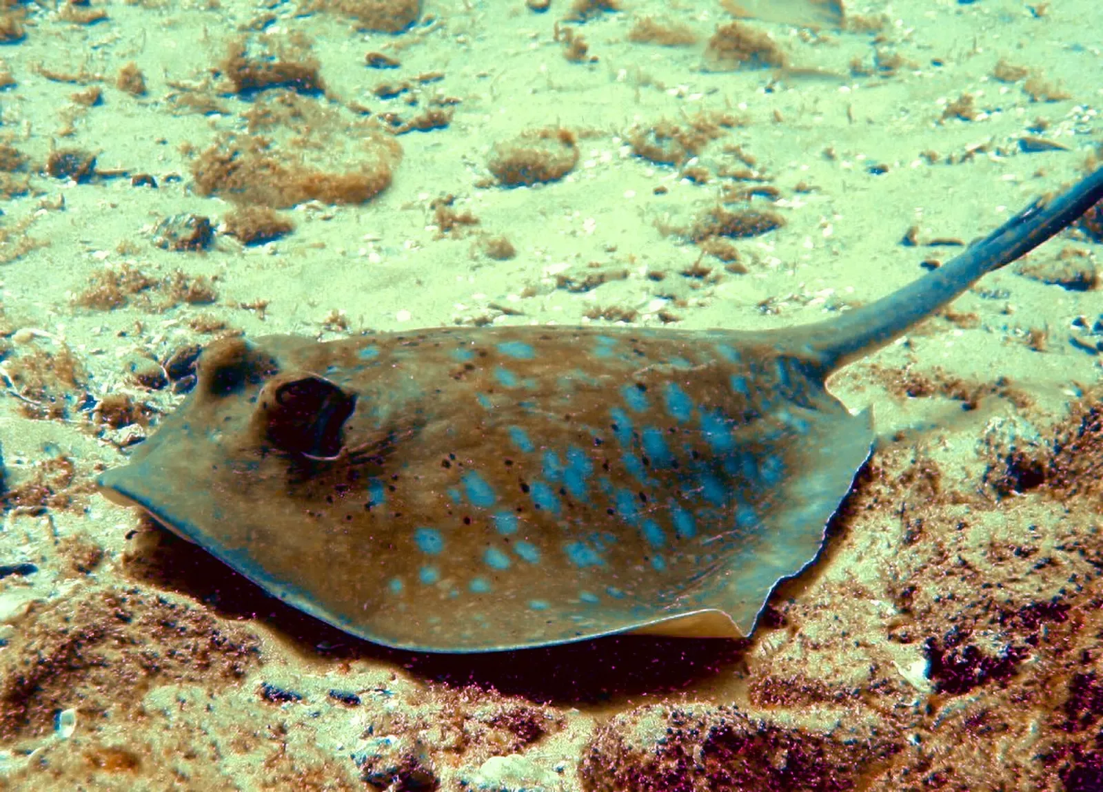
Schooling fish pack the arches in every month, thickest in the warm January-to-April stretch when the current carries subtropical strays from the north. Short-tailed stingrays gather at the arches in late summer and autumn. Trevally and kingfish work the current lines, eagle rays cross the sand at the bay mouths, octopus and nudibranchs sit on the walls, and dolphins join the crossing.
- Cave & cavern
- Wall
- Reef
- Drift
- Reef fish swarms
- Stingrays
- Eagle rays
- Dolphins
- Trevally & jacks
- Octopus & cuttlefish
- Nudibranchs
Best dive sites in Poor Knights Islands
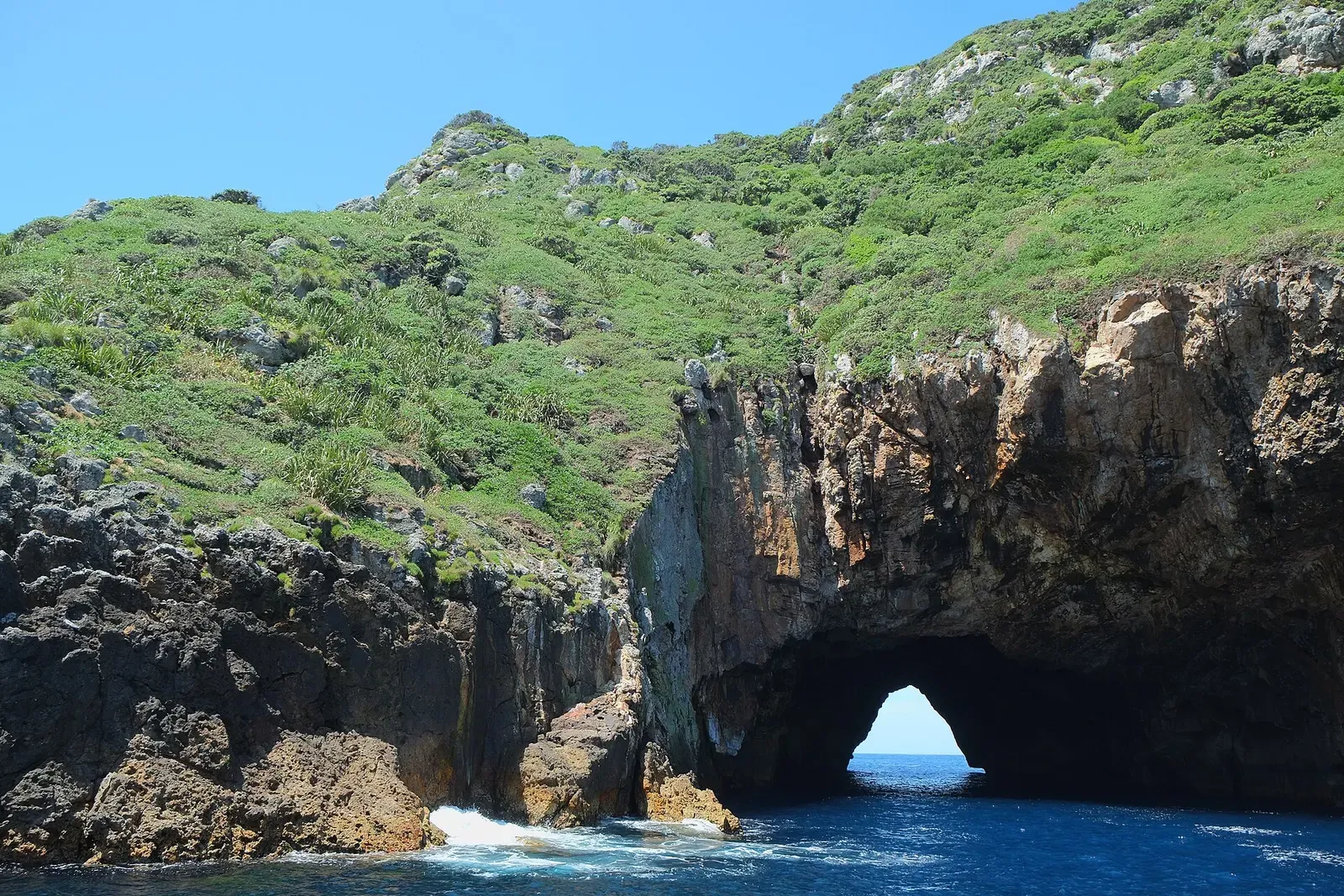
Schools of blue maomao packed into an eight-metre arch
Channel & pass
An underwater air bubble cave beside drop-offs past 40 metres
A 12-15 metre gap over a 40 metre bottom, stacked with stingrays
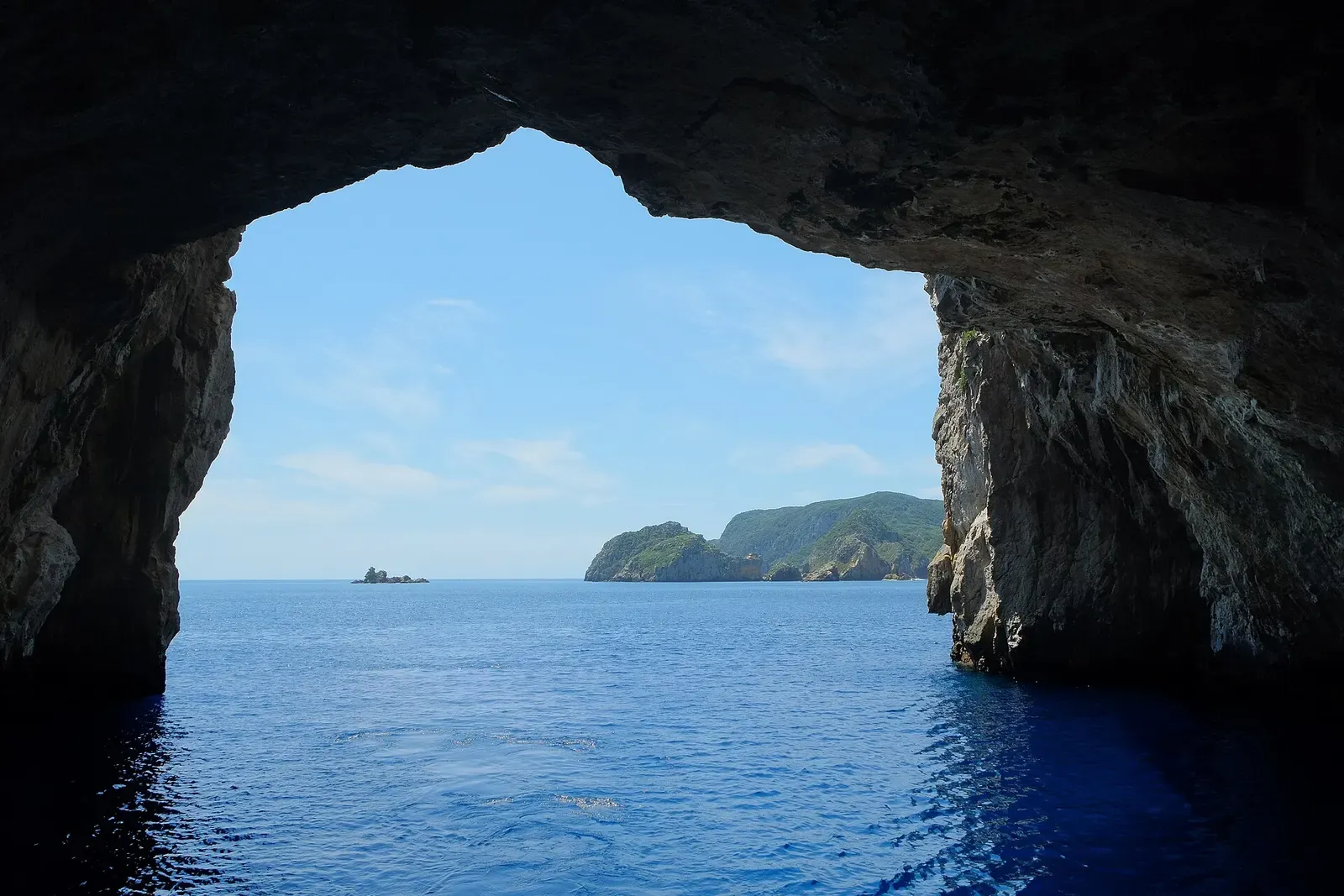
A large whale jaw bone on the sand at 12 metres, inside the cave
Landing Bay Pinnacle
Sheltered pinnacle popular for its abundant reef fish.
How to get to Poor Knights Islands
Everything runs from Tutukaka, about half an hour from Whangarei and roughly two and a half hours' drive north of Auckland; most divers drive up and stay in Tutukaka or Ngunguru. Boats leave in the morning and are back mid-afternoon. Landing on the islands is prohibited, so there is no shore diving and nowhere to stay out there.
Photos from Poor Knights Islands
Peter Southwood · CC BY-SA 3.0
Pseudopanax at English Wikipedia · CC BY 4.0
Dive videos
Scuba Diving The POOR KNIGHTS In New Zealand · Blue Horizon Diving on YouTube
Poor Knights Diving | North Island New Zealand · Pursuing Mountains on YouTube
Photo credits
- A diver swims through the sunlit Northern Arch at the Poor Knights Islands. by Anna Barnett, CC BY 2.0, via Wikimedia Commons
- A soft coral fan grows on the reef at Aorangaia, Poor Knights Islands. by Peter Southwood, CC BY-SA 3.0, via Wikimedia Commons
- View from inside Rikoriko Cave looking out toward Kaka Rock and Tawhiti Rahi Island. by Pseudopanax at English Wikipedia, CC BY 4.0, via Wikimedia Commons
Embed
Run a dive centre, club or blog? Embed this map of 4 dive sites near Poor Knights Islands on your own page.
In The Logbook
- Cavern and cenote diving without cave trainingCaves & caverns · 8 min read
Similar destinations
A 125 m ocean through-cave, and grey nurse sharks in the gutters

Tropical and temperate species overlap on one rock 2.5 km offshore

The world's southernmost coral reef, with advanced diving at Balls Pyramid offshore.


The scuttled Rainbow Warrior under a coat of jewel anemones at 26 m