Cold Water · Austria
Attersee
A 169 m alpine lake ringed with shore dives, a sunken forest and a notorious deep wall
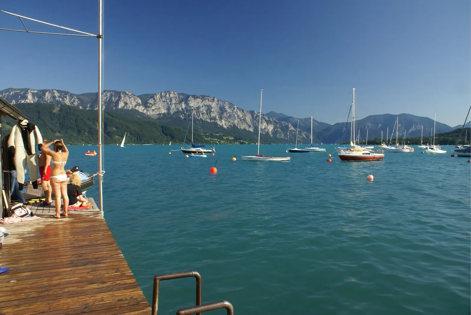
Photo: Florian Prischl · CC BY-SA 3.0
Attersee is the largest lake in the Salzkammergut and, at 169 m on official maps, the second-deepest lake in Austria after the Traunsee. Meltwater clarity and a ring of shore-entry points around Steinbach, Weyregg, Weissenbach and Unterach have made it the best-known inland dive destination in the German-speaking world. Divers here work a submerged forest, a notorious deep wall and a training culture built around drysuits and altitude procedures, coordinated since 2006 by a joint diving-competence association of local dive centres.
About diving in Attersee
The Attersee formed like every Salzkammergut lake, carved by the Traun glacier during the ice ages, and now covers 46.2 km2 and holds roughly 3.9 billion cubic metres of water at 469 m above sea level. Official maps put its deepest point at 169 m, and in 2014 divers reported finding a spot 172.6 m down, though that figure has not been independently confirmed. Larger lakeside settlements are Seewalchen and Schörfling to the north, Weyregg and Steinbach to the east, and Unterach, Nussdorf and Attersee am Attersee to the west, with the Ager river draining the lake north into the Traun and eventually the Danube.
More than twenty marked shore entry points ring the lake, maintained by the Tauchkompetenz-Zentrum Attersee, an association founded in 2006 by around forty local dive businesses; Weyregg alone has two dive centres. The entries range from flat training platforms with sunk cars and rowboats to steep walls and a field of drowned trees, and diving continues through winter, when the water is at its clearest. From the first Sunday of Advent to Candlemas on 2 February, a diving-club installation turns a submerged pile-dwelling model at Weyregg into an underwater nativity scene, built with students of HTL Vöcklabruck and described locally as unique in Europe.
The lake's reputation among divers is mixed with its risks. Rescue-service records list thirteen divers recovered dead between 1971 and February 2009 in the area of the Schwarze Brücke wall alone, and in 2005 Hans Brandstätter set an Austrian depth record here of 165 m. A landslide in September 1959 between Kammer and Weyregg pushed a stand of trees into the lake, and up to 20 m long trunks still lie in 15 to 30 m of water as the Unterwasserwald. Near the surface the lake warms to over 20°C in August, but below the thermocline it holds close to 4.6 to 4.9°C all year, so a drysuit is not optional once a dive goes past the first few metres.
When to dive Attersee
| Jan | Feb | Mar | Apr | May | Jun | Jul | Aug | Sep | Oct | Nov | Dec |
|---|---|---|---|---|---|---|---|---|---|---|---|
| Prime | Prime | Good | Good | Good | Good | Fair | Fair | Good | Good | Good | Prime |
Diving runs year-round; visibility peaks near 30 m in winter, while July and August bring more bathers, boat traffic and sometimes murkier water.
Dive types & marine life
Pike, perch, roach and eels are the common sightings around the wrecks, boulders and drowned trees, with eels mostly seen on night dives. A stretch near the Weissenbach inflow is closed to divers during the autumn spawning season. Clarity and geology, not fish life, are what draw divers to the Attersee.
- Freshwater
- Wall
- Freshwater fish
Notable dive sites in Attersee
Freshwater
A submerged pile-dwelling model that becomes a nativity scene every Advent to Candlemas
A rowing boat nicknamed the 'Titanic' sits at 32 m below the Unterach wall
Wall
A limestone wall dropping in stages past 100 m, capped at 40 m for recreational divers
Freshwater
A stand of trees up to 20 m long, sunk by a 1959 landslide, still lying on the lakebed
Ofen
Shallow Steinbach entry with old oven remains at 4 m and a wooden boat below.
Getting there
Salzburg is about 55 km away, Linz 85 km and Vienna around 250 km, all reached via the A1 motorway to St. Georgen im Attergau; a branch railway from Voecklamarkt and buses from Voecklabruck also serve the lake. Diving is shore-only, from small car parks at each marked entry point, some with only a handful of spaces.
Photos from Attersee
Carsten Tolkmit from Kiel, Germany · CC BY-SA 2.0
Herbert wie · CC BY-SA 4.0
Photo credits
- Sailing boats moored on Attersee with the Höllengebirge rising behind by Florian Prischl, CC BY-SA 3.0, via Wikimedia Commons
- Yachts on the calm surface of Attersee with hazy mountains beyond by Carsten Tolkmit from Kiel, Germany, CC BY-SA 2.0, via Wikimedia Commons
- Small boats and jetties along the shallow turquoise shore at Nussdorf by Herbert wie, CC BY-SA 4.0, via Wikimedia Commons
In The Logbook
- Diving at altitude: why the rules changeBody & health · 7 min read
- Why the water steals your heatBody & health · 8 min read
- Buoyancy and weighting, worked outGear & kit · 8 min read
- Freshwater diving: lakes, springs and quarriesFreshwater · 15 min read
Similar destinations
A flooded chalk quarry with a hovering aircraft and a 55 m drop-off
Cold Water
Silfra
Iceland
Visibility measured in tens of metres inside a rift between two tectonic plates
A flooded granite quarry with a sunken tug, a helicopter and a submarine replica


.jpg)

Snowmelt so clear you can see the trees from the riverbed