Mount Gambier · Australia · Freshwater · Drift
Ewens Ponds
Drift through three linked limestone ponds on an Open Water certificate alone
Area photo: Mark Whatmough · CC BY 2.0
Three limestone dolines about 9 to 13 m deep, linked by shallow channels called races, on Eight Mile Creek south of Mount Gambier. Divers and snorkellers enter at the First Pond and drift downstream to exit at the Third, past aquatic plants visible more than 80 m away in the clearest water. No CDAA rating is needed here, only an Open Water-equivalent certificate, which makes it the easiest of the area's sinkholes to visit.
Where it is and how deep
38.0267° S, 140.7906° EPublished position for this site.
The dive
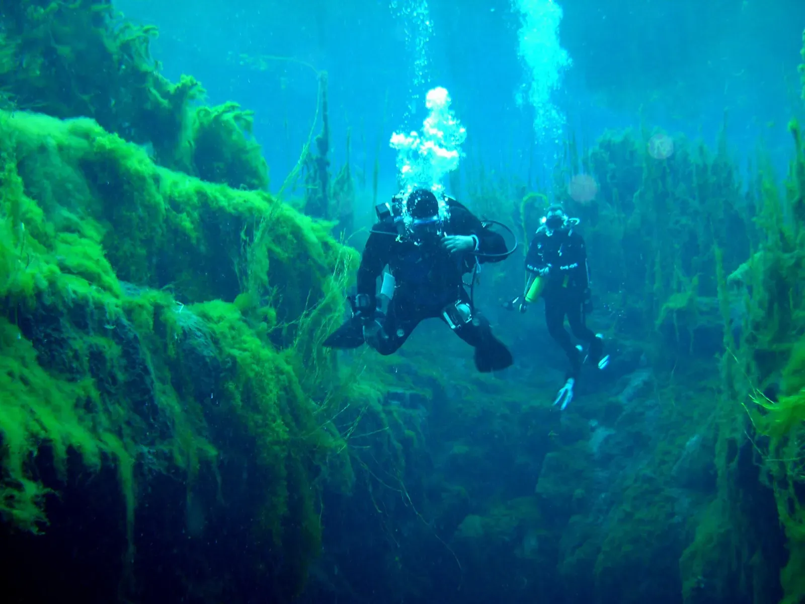
The dive is a one-way drift: in at the First Pond, downstream through the First Race to the Second Pond, on through the Second Race to the Third, and out by ladder. Each pond is a basin-shaped doline roughly 9 to 13 m deep with a silt floor, and the races between them are shallow, weed-lined channels a few metres wide where the current does the work of moving you along.
Clarity is the reason to come. Aquatic plants growing on the pond beds can be seen from more than 80 m away in places, and they reach up to 6 m tall in the light this water lets through — some of them do not grow fully submerged anywhere else in the world. Watch closely and you can see photosynthesis happening in real time, as plants release fine trails of bubbles into the current.
Divers are prohibited from entering the caves and crevices on the pond beds, and are strongly discouraged from swimming back upstream against the current to return to an earlier pond, since both stir the silt layer and damage the plants lining the races for whoever comes through next. The water sits around 10 to 15 °C year-round, cool enough that a full-length wetsuit is compulsory rather than optional.
Background
The ponds take their name from Thomas Ewens, whose dog chased a kangaroo into one of them while he was hunting geese; he reported the find to the survey department and they were first known as Thomas Ewens Spring Ponds. A trout farm established in 1978 still draws water from the Second Pond, even though the ponds themselves became a conservation park in 1976. The site is one of only three recorded locations for the endangered golden pygmy perch.
Marine life and season
- Freshwater fish
| Jan | Feb | Mar | Apr | May | Jun | Jul | Aug | Sep | Oct | Nov | Dec |
|---|---|---|---|---|---|---|---|---|---|---|---|
| Good | Good | Good | Good | Prime | Prime | Prime | Prime | Fair | Fair | Fair | Good |
Season follows Mount Gambier: Every site is spring- or aquifer-fed, so temperature holds steady all year; the one fixed closure is Ewens Ponds from 1 September to 30 November, and winter is reported as Kilsby's clearest water.
Know before you go
- Entering caves or crevices on the pond beds is prohibited; a natural shallow cave sits in the floor of the Third Pond.
- Swimming upstream against the current to return to an earlier pond is strongly discouraged: it silts the water and damages the races' plant life for the next group.
- Full-length wetsuits are mandatory in water that runs 10 to 15 °C year-round.
Questions divers ask
Can beginners dive Ewens Ponds?+
Yes. Parks SA sets the minimum qualification at ISO 24801-2 Autonomous Diver, equivalent to an entry-level PADI, SSI or NAUI Open Water certificate or CMAS one star, with no cave or cavern rating required.
Why are Ewens Ponds closed some months?+
The park is closed to snorkelling and diving every year from 1 September to 30 November inclusive, a fixed calendar closure rather than a weather-dependent one.
How does the dive route work?+
It is one-way with the current: enter at the First Pond, drift through the connecting races to the Second and Third Ponds, and exit by ladder at the Third. Swimming back upstream is discouraged.
Sources
- Ewens Ponds — Wikipedia
- Ewens Ponds Conservation Park — Wikipedia
- Ewens Ponds Conservation Park — Parks SA
In The Logbook
- Freshwater diving: lakes, springs and quarriesFreshwater · 15 min read
More dive sites in Mount Gambier
Cave & cavern
A flooded cave running under the streets of Mount Gambier
Freshwater
A roadside sinkhole in 30-million-year-old limestone
Freshwater
The area's cave-training sinkhole, CDAA-rated Basic Cave
Freshwater
Farmland sinkhole diving to 40 m in water that runs 30 to 60 m of visibility
Freshwater
A 50 m cenote starting at 25 m, with a 1966 car resting on its silty floor
Freshwater
A limestone chasm over 100 m deep, reached through a Ramsar wetland pond
Freshwater
A metre-wide hole in a paddock over a 140 m chamber
Similar dives elsewhere
A one-way drift over popcorn springs in 30 m (100 ft) of visibility
An intensely blue limestone spring, seven metres at its deepest

The lake's most popular summer night dive, free and shallow
An artificial reef under the red marker buoy at 9 m