Australia & New Zealand · Australia
Mount Gambier — Limestone Coast
Freshwater sinkholes and spring ponds gated by CDAA ratings, not tide tables
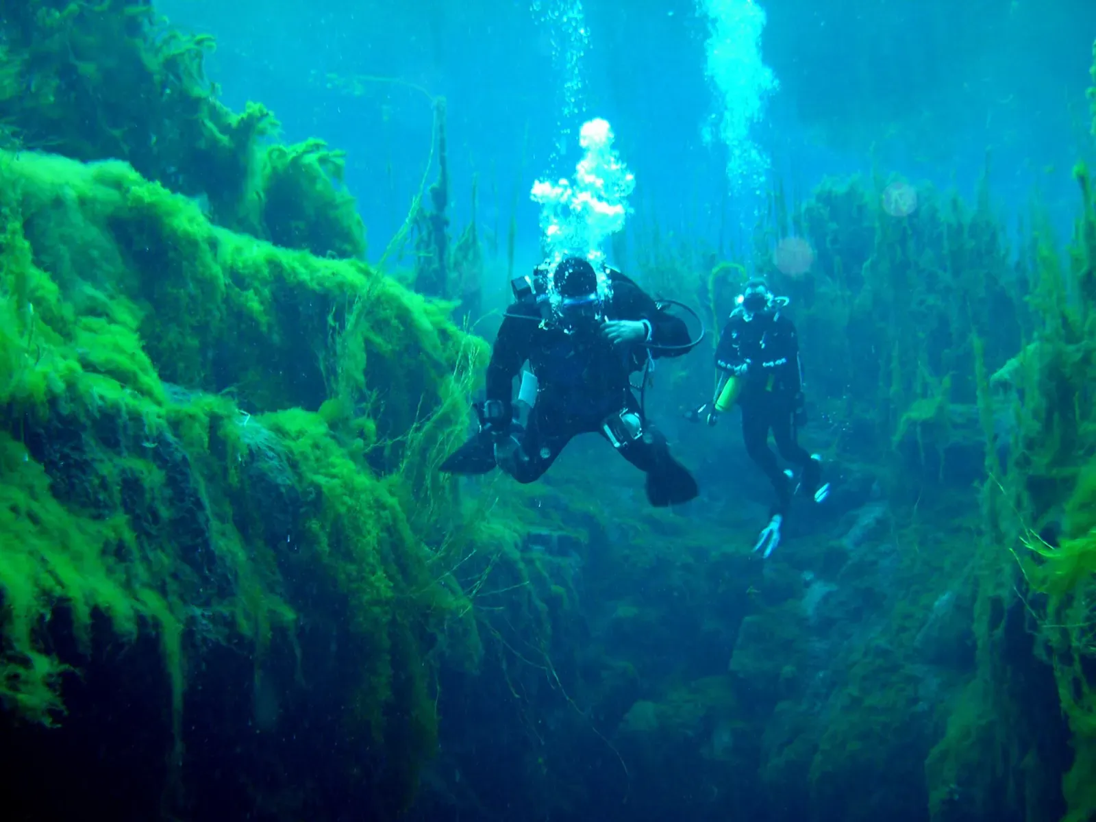
Photo: Mark Whatmough · CC BY 2.0
Mount Gambier sits on a limestone plateau in South Australia's south-east, where freshwater under pressure has dissolved the karst into a cluster of flooded sinkholes and spring-fed ponds of extraordinary clarity. Piccaninnie Ponds, Ewens Ponds, Kilsby Sinkhole and Little Blue Lake make this Australia's best-known freshwater diving ground, and access to most of it runs through the Cave Divers Association of Australia's rating system and Parks SA permits rather than any dive shop.
About diving in Mount Gambier — Limestone Coast
The Limestone Coast sits on Gambier Limestone, a soft Miocene rock that groundwater has been dissolving for millions of years into caves, cenotes and collapse sinkholes. Mount Gambier itself is a dormant maar volcano whose own crater holds the Blue Lake, a 75 m town water-supply lake that turns from grey to vivid blue each November; it is not diveable, but it sets the scene for a region built on volcanic and karst geology working on each other. The four sites divers actually visit lie in a ring around the city, each a separate flooded doline rather than a connected system.
What makes this area unusual is who runs it. Piccaninnie Ponds and Ewens Ponds are Parks SA conservation parks booked through one-hour permitted time slots; Kilsby Sinkhole and Little Blue Lake sit on private or council land with their own access rules. Independent diving at three of the four requires current membership of the Cave Divers Association of Australia (CDAA) and a site rating, most commonly Basic Cave, which the CDAA also calls sinkhole category on its own permit paperwork. Only Ewens Ponds asks nothing more than an ISO 24801-2 Open Water-equivalent certificate, which is why it is usually the first stop for visiting divers before CDAA membership is sorted.
In the city itself, Engelbrecht Cave is run as a separate tourist cave-diving venue and is often the introduction locals give visiting divers before they head out to the sinkholes proper. Tourism from the whole cluster of craters, caves and sinkholes is worth an estimated 100 million dollars a year to the Mount Gambier economy, and cave divers travel from well outside Australia specifically for it. None of it reads like ordinary scuba diving: there is no reef, no current to speak of at most sites, and the appeal is entirely about looking through impossibly clear fresh water at limestone rather than at fish.
When to dive Mount Gambier — Limestone Coast
| Jan | Feb | Mar | Apr | May | Jun | Jul | Aug | Sep | Oct | Nov | Dec |
|---|---|---|---|---|---|---|---|---|---|---|---|
| Good | Good | Good | Good | Prime | Prime | Prime | Prime | Fair | Fair | Fair | Good |
Every site is spring- or aquifer-fed, so temperature holds steady all year; the one fixed closure is Ewens Ponds from 1 September to 30 November, and winter is reported as Kilsby's clearest water.
Dive types & marine life
Fish are a minor part of the appeal. Ewens Ponds holds the endangered golden pygmy perch, short-finned eel, river blackfish and common galaxias, and Kilsby has its own population of galaxias; Little Blue Lake and the deeper reaches of Piccaninnie Ponds hold little life at all. Water clarity, not wildlife, is what the season ratings above track.
- Freshwater
- Cave & cavern
- Freshwater fish
Notable dive sites in Mount Gambier — Limestone Coast
Cave & cavern
A flooded cave running under the streets of Mount Gambier
Freshwater
Drift through three linked limestone ponds on an Open Water certificate alone
Freshwater
A roadside sinkhole in 30-million-year-old limestone
Freshwater
The area's cave-training sinkhole, CDAA-rated Basic Cave
Freshwater
Farmland sinkhole diving to 40 m in water that runs 30 to 60 m of visibility
Freshwater
A 50 m cenote starting at 25 m, with a 1966 car resting on its silty floor
Freshwater
A limestone chasm over 100 m deep, reached through a Ramsar wetland pond
Freshwater
A metre-wide hole in a paddock over a 140 m chamber
Getting there
Mount Gambier has a small regional airport with direct flights from Adelaide and Melbourne; most visitors instead drive, since the city is 450 km south-east of Adelaide by road. All four sites lie within a 40-minute drive of town, and a hire car is effectively compulsory since every dive is shore access on back roads with no dive-shop shuttle service.
Photos from Mount Gambier — Limestone Coast
No machine-readable author provided. Roo72 assumed (based on copyright claims). · CC BY-SA 3.0
User:Chuq · Public domain
Photo credits
- Two divers among weed in the clear blue-green water of Piccaninnie Ponds by Mark Whatmough, CC BY 2.0, via Wikimedia Commons
- The vivid blue crater lake at Mount Gambier seen from the vegetated rim by No machine-readable author provided. Roo72 assumed (based on copyright claims)., CC BY-SA 3.0, via Wikimedia Commons
- Blue Lake filling its crater with steep bush-covered slopes around it by User:Chuq, Public domain, via Wikimedia Commons
In The Logbook
- How a rebreather works, and what it buys youGear & kit · 6 min read
- Blue holes: what's actually down thereCaves & caverns · 13 min read
- Buoyancy and weighting, worked outGear & kit · 8 min read
- Why the sea is blue, and your photos greyOcean science · 7 min read
- Freshwater diving: lakes, springs and quarriesFreshwater · 15 min read
Similar destinations
A 133 m destroyer scuttled off Seal Island, 20 minutes from the marina

The scuttled Rainbow Warrior under a coat of jewel anemones at 26 m

Weedy seadragons drift through cold-water kelp forests off the Tasman Peninsula.


White quartz sand lifts the light over temperate sponge gardens