Mount Gambier · Australia · Freshwater · Cave & cavern
Piccaninnie Ponds
A limestone chasm over 100 m deep, reached through a Ramsar wetland pond
Area photo: Mark Whatmough · CC BY 2.0
A Ramsar-listed karst wetland 32 km south-east of Mount Gambier, built around three named features: the First Pond at about 10 m, the enclosed limestone Cathedral at about 35 m, and the Chasm, a sinkhole plunging past 100 m. Visibility can exceed 40 m. Diving is CDAA members only, rated at sinkhole category, and both diving and snorkelling run through one-hour Parks SA permit slots.
Where it is and how deep
38.0508° S, 140.9364° EApproximate position — the dashed circle shows where the site lies; your operator's briefing has the mooring.
The dive
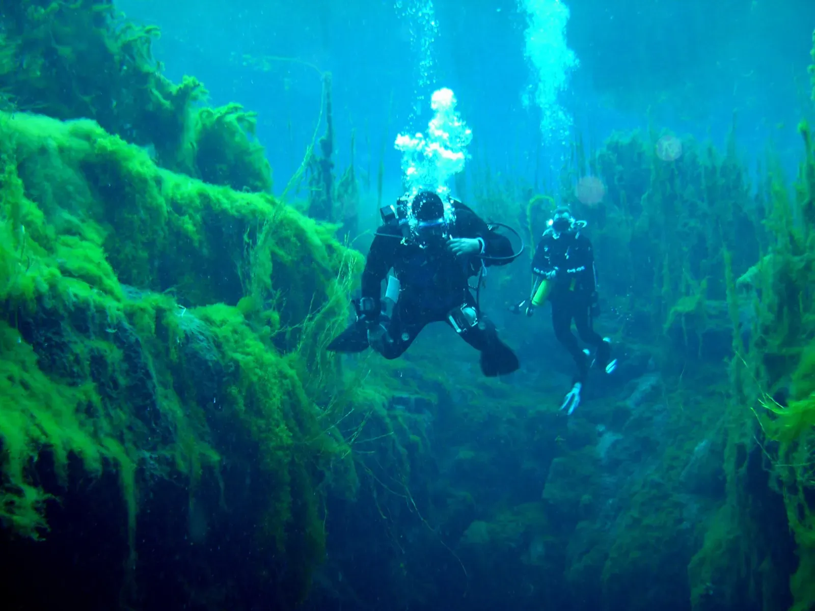
Every dive starts at the First Pond, an open, silt-floored depression about 10 m deep with a vegetated fringe that Valerie Taylor, diving here in 1964–65, called one of the most beautiful sights in Australia. Freshwater rises through the limestone under pressure, which is what has carved the two features divers actually come for, and is also why the water column above them can run to more than 40 m of visibility on a good day.
The Cathedral is the enclosed one: a chamber roughly 35 m deep with white, scalloped limestone walls shaped by the same erosion that formed the Chasm. It reads as architecture rather than open water, walls closing around you rather than a reef falling away, and the permit system only allows diving inside the First Pond, the Chasm and the Cathedral — nowhere else in the park.
The Chasm is the sinkhole proper, a shaft the same freshwater pressure has opened to a depth of over 100 m. No permit lets you follow it that far: CDAA divers rated at sinkhole category are capped at 36.5 m by the conditions of the permit itself, so the deeper two-thirds of the Chasm are there to be aware of rather than to visit. Groups are small by design, two to three divers plus a possible instructor on a supervised first dive, each holding a separate permit for the same one-hour slot.
Background
Gazetted as a national park in 1969 and now a Ramsar-listed karst wetland, Piccaninnie Ponds was already known to divers before its protection: underwater explorer Valerie Taylor described the ponds in 1964–65 as one of the most beautiful sights in Australia. Three fatal diving accidents in 1972, 1974 and 1984 led to the current CDAA-only, sinkhole-category permit system that still governs access.
Marine life and season
- Freshwater fish
| Jan | Feb | Mar | Apr | May | Jun | Jul | Aug | Sep | Oct | Nov | Dec |
|---|---|---|---|---|---|---|---|---|---|---|---|
| Good | Good | Good | Good | Prime | Prime | Prime | Prime | Fair | Fair | Fair | Good |
Season follows Mount Gambier: Every site is spring- or aquifer-fed, so temperature holds steady all year; the one fixed closure is Ewens Ponds from 1 September to 30 November, and winter is reported as Kilsby's clearest water.
Know before you go
- Divers have died exploring the caves beneath Piccaninnie Ponds in 1972, 1974 and 1984; stay within the permitted depth and features.
- The permit limit of 36.5 m exists because the Chasm continues past 100 m with no floor in sight from the shallower sections.
- The park has previously closed all water entry for weeks at a time after algae outbreaks; confirm the closure status before travelling.
Questions divers ask
How deep can you dive at Piccaninnie Ponds?+
The Chasm itself runs past 100 m, but every permit caps the dive at 36.5 m regardless of certification; the First Pond and Cathedral sit well inside that limit at about 10 m and 35 m.
Do I need to be a CDAA member to dive here?+
Yes. Diving permits are only issued to current financial members of the Cave Divers Association of Australia who are rated at sinkhole category; snorkelling needs only a signed indemnity form.
Is Piccaninnie Ponds currently open for diving?+
Check before travelling. Parks SA has previously suspended all diving and snorkelling permits for extended periods to let aquatic vegetation recover after filamentous algae outbreaks.
Sources
- Piccaninnie Ponds Conservation Park — Wikipedia
- Piccaninnie Ponds Conservation Park — Parks SA
- Piccaninnie Ponds — Cave Diving & Snorkelling Permits, Mount Gambier — Mount Gambier Point
In The Logbook
- Freshwater diving: lakes, springs and quarriesFreshwater · 15 min read
More dive sites in Mount Gambier
Cave & cavern
A flooded cave running under the streets of Mount Gambier
Freshwater
Drift through three linked limestone ponds on an Open Water certificate alone
Freshwater
A roadside sinkhole in 30-million-year-old limestone
Freshwater
The area's cave-training sinkhole, CDAA-rated Basic Cave
Freshwater
Farmland sinkhole diving to 40 m in water that runs 30 to 60 m of visibility
Freshwater
A 50 m cenote starting at 25 m, with a 1966 car resting on its silty floor
Freshwater
A metre-wide hole in a paddock over a 140 m chamber
Similar dives elsewhere
Carbonate bells up to 2 m long hanging at 30 m
Tree branches standing out of a sulphide cloud at 30 m
A sinkhole dived to 220 m without anyone finding the bottom


Boulder swim-throughs under a 100 m cliff, from 6 m to 35 m