
Mediterranean · Spain
Cabo de Palos & Islas Hormigas
Dusky groupers the size of car doors patrol two submerged mountains
Photo: Marta T López · CC BY-SA 4.0
Protected since 1995, the reserve off Cabo de Palos is the strongest argument in Spain for what a no-take zone does to a Mediterranean reef. Two submerged mountains, Bajo de Fuera and Bajo de Dentro, rise from 50 m to within a few metres of the surface, and their summits carry dusky groupers of a size seen almost nowhere else in the western Mediterranean, along with permanent barracuda schools and passing tuna. Three nineteenth- and twentieth-century wrecks lie on the flanks.
About diving in Cabo de Palos & Islas Hormigas
Everything is done by boat from the village harbour, and the reserve's rules shape the day: authorised centres, guided groups, mooring buoys on the summits rather than anchors, and a briefing that is as much about depth discipline as about the route. Descents run down a line, and the usual pattern is to take the deep flank first, then work back up the rock and finish in the shallows on top, where the fish are thickest and the safety stop sorts itself out.
Two seamounts do most of the work. Bajo de Dentro is the more manageable, a summit at around 12 m with walls falling to 40 m and barracuda and dentex stacked above it. Bajo de Fuera is the outer, more exposed mountain, rising from roughly 50 m to within a few metres of the surface, and it is where the reserve's reputation was made. Three wrecks lie on the flanks, the Sirio, the Naranjito and the Stanfield, and they are dives in their own right rather than detours from the rock.
The signature experience here is stationary. Dusky groupers that have not been hunted since 1995 sit out in the open and let divers approach, so a fish that is wary almost everywhere else in the western Mediterranean behaves as though it knows where the reserve boundary runs. Around them, barracuda hold in permanent schools over the summits and tuna cut past in open water, usually at the edge of visibility rather than close in.
This is not a beginner's destination. Current runs moderate and shifts with the wind and swell on exposed rock, the wrecks and the best fish action sit past 35 m, and easterlies cancel boats at any time of year. It suits experienced divers comfortable with deep, current-swept seamounts, and nitrox earns its keep across a two-dive day. Winter gives the clearest water but the coldest, while June to October brings the calmest crossings.
Best time to dive Cabo de Palos & Islas Hormigas
| Jan | Feb | Mar | Apr | May | Jun | Jul | Aug | Sep | Oct | Nov | Dec | |
|---|---|---|---|---|---|---|---|---|---|---|---|---|
| Season | Fair | Fair | Fair | Good | Good | Prime | Prime | Prime | Prime | Prime | Good | Fair |
| Sea surface | 15°C59°F | 15°C59°F | 15°C59°F | 16°C61°F | 19°C66°F | 22°C72°F | 26°C79°F | 27°C81°F | 26°C79°F | 23°C73°F | 19°C66°F | 17°C63°F |
| Daytime high | 18°C64°F | 18°C64°F | 19°C66°F | 20°C68°F | 23°C73°F | 27°C81°F | 29°C84°F | 30°C86°F | 28°C82°F | 26°C79°F | 23°C73°F | 19°C66°F |
| Rain | 33 mm1.3 in | 16 mm0.6 in | 50 mm2.0 in | 36 mm1.4 in | 24 mm0.9 in | 11 mm0.4 in | 4 mm0.2 in | 13 mm0.5 in | 37 mm1.5 in | 37 mm1.5 in | 43 mm1.7 in | 39 mm1.5 in |
| Jan | Feb | Mar | Apr | May | Jun |
|---|---|---|---|---|---|
| Fair | Fair | Fair | Good | Good | Prime |
| Sea surface | |||||
| 15°C59°F | 15°C59°F | 15°C59°F | 16°C61°F | 19°C66°F | 22°C72°F |
| Daytime high | |||||
| 18°C64°F | 18°C64°F | 19°C66°F | 20°C68°F | 23°C73°F | 27°C81°F |
| Rain | |||||
| 33 mm1.3 in | 16 mm0.6 in | 50 mm2.0 in | 36 mm1.4 in | 24 mm0.9 in | 11 mm0.4 in |
| Jul | Aug | Sep | Oct | Nov | Dec |
|---|---|---|---|---|---|
| Prime | Prime | Prime | Prime | Good | Fair |
| Sea surface | |||||
| 26°C79°F | 27°C81°F | 26°C79°F | 23°C73°F | 19°C66°F | 17°C63°F |
| Daytime high | |||||
| 29°C84°F | 30°C86°F | 28°C82°F | 26°C79°F | 23°C73°F | 19°C66°F |
| Rain | |||||
| 4 mm0.2 in | 13 mm0.5 in | 37 mm1.5 in | 37 mm1.5 in | 43 mm1.7 in | 39 mm1.5 in |
2011–2025 averages. Sea surface: NOAA Coral Reef Watch, measured at the surface, so deeper water can run colder. Daytime high and rain: NASA POWER.
Jun–Oct has the warmest water and the calmest crossings; winter is clearest but cold, and easterly winds close the seamounts year-round.
Best months: June, July, August, September, October
Cabo de Palos water temperature and weather by month
The sea surface runs from 15 °C (59 °F) in February to 27 °C (81 °F) in August. It is 24 °C (75 °F) or warmer from July to September. Most rain falls from March and April, peaking at about 50 mm (2 in) in March; June to August are the driest. Daytime highs reach 30 °C (86 °F) in August and drop to 18 °C (64 °F) in February. The coldest water here is about 14 °C (57 °F), so pack a 7 mm suit with a hood, or a semi-dry.
Dive types & marine life
Dusky groupers are resident and seen on most dives; barracuda hold in permanent schools over the summits, and tuna pass through open water, most often across the warm June to October stretch. Octopus and cuttlefish work the shallower rock, and nudibranchs are best in the cold, clear months at either end of the year.
- Seamount
- Wall
- Wreck
- Reef
- Drift
- Groupers
- Barracuda
- Tuna
- Octopus & cuttlefish
- Nudibranchs
- Reef fish swarms
Best dive sites in Cabo de Palos & Islas Hormigas
A rock needle to 3 m, with a conger cave at 22 m on its east side
Seamount
A submerged mountain from 55 m to 3 m, four hulls on its flanks
Reef
Blocks, caves and furrows in the south face that took ships' anchors
Pinnacle
A rock spine with a crest at 12 m and groupers along its length
Gorgonians on the vertical north wall of a submerged island
Pinnacle
A steep gorge to 25 m holding the remains of an old anchorage
Steps from the lighthouse car park into the cape's main shore dive
Reef
Shallow cove diving at the foot of the Cabo de Palos lighthouse
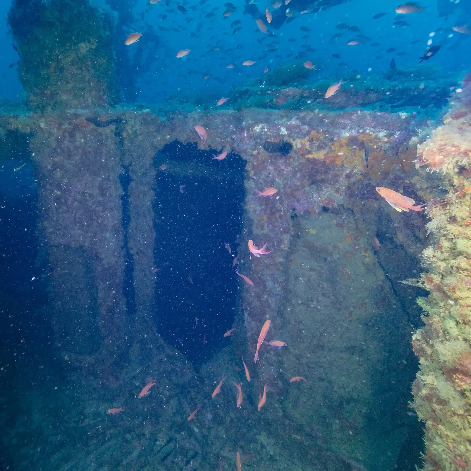
Intact 1946 orange freighter, forecastle at 28 m, stern at 45
Wreck
An 1884 emigrant liner, now wreckage dived under reserve permit
Stanfield
British steamer lost in 1899, deep on the seamount flank past 40 m.
Isla Hormiga
The islet itself, with shallower walls used when the swell is up.
How to get to Cabo de Palos & Islas Hormigas
Alicante is the usual arrival airport, with Murcia closer and Cartagena the nearest city of size. Diving is boat-only from Cabo de Palos village, where the operators cluster by the harbour. Plan around the wind, as easterlies close the seamounts at short notice.
Photos from Cabo de Palos & Islas Hormigas
Jouni Kuisma, DiveCodex · CC BY-SA 4.0
Jouni Kuisma, DiveCodex · CC BY-SA 4.0
Jouni Kuisma, DiveCodex · CC BY-SA 4.0
Pimawipa · CC BY-SA 4.0
Dive videos
BUCEO EN CABO DE PALOS 🐳 4K *Mediterráneo Salvaje* · Oceanovideo on YouTube
DIVING CABO PALOS PECIO NARANJITO · PATXI URUBURU on YouTube
Photo credits
- White lighthouse on the rocky islet of Isla Hormiga surrounded by deep blue sea by Marta T López, CC BY-SA 4.0, via Openverse
- Pink Edmundsella pedata nudibranch on a rocky ledge with blue water behind by Jouni Kuisma, DiveCodex, CC BY-SA 4.0, via Openverse
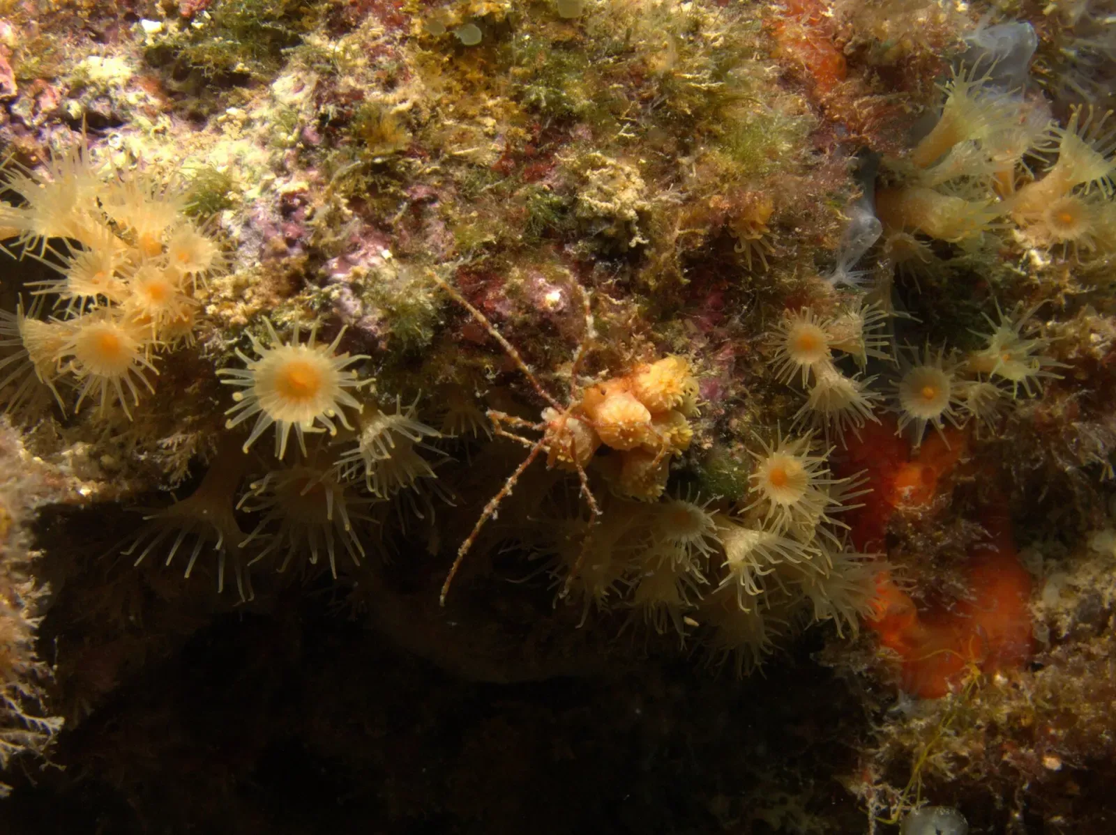
- Long-legged spider crab camouflaged among yellow cluster anemones on the reef by Jouni Kuisma, DiveCodex, CC BY-SA 4.0, via Openverse
- Pale lace-like Neptune bryozoan colony on an algae-covered rock face by Jouni Kuisma, DiveCodex, CC BY-SA 4.0, via Openverse
- Cabo de Palos lighthouse standing on a rocky headland above a calm cove by Pimawipa, CC BY-SA 4.0, via Wikimedia Commons
Embed
Run a dive centre, club or blog? Embed this map of 12 dive sites near Cabo de Palos on your own page.
In The Logbook
- Sunfish diving: where and when to see a molaBig animals · 11 min read
- Air, nitrox or trimix: which gas, and when?Gear & kit · 15 min read
Similar destinations
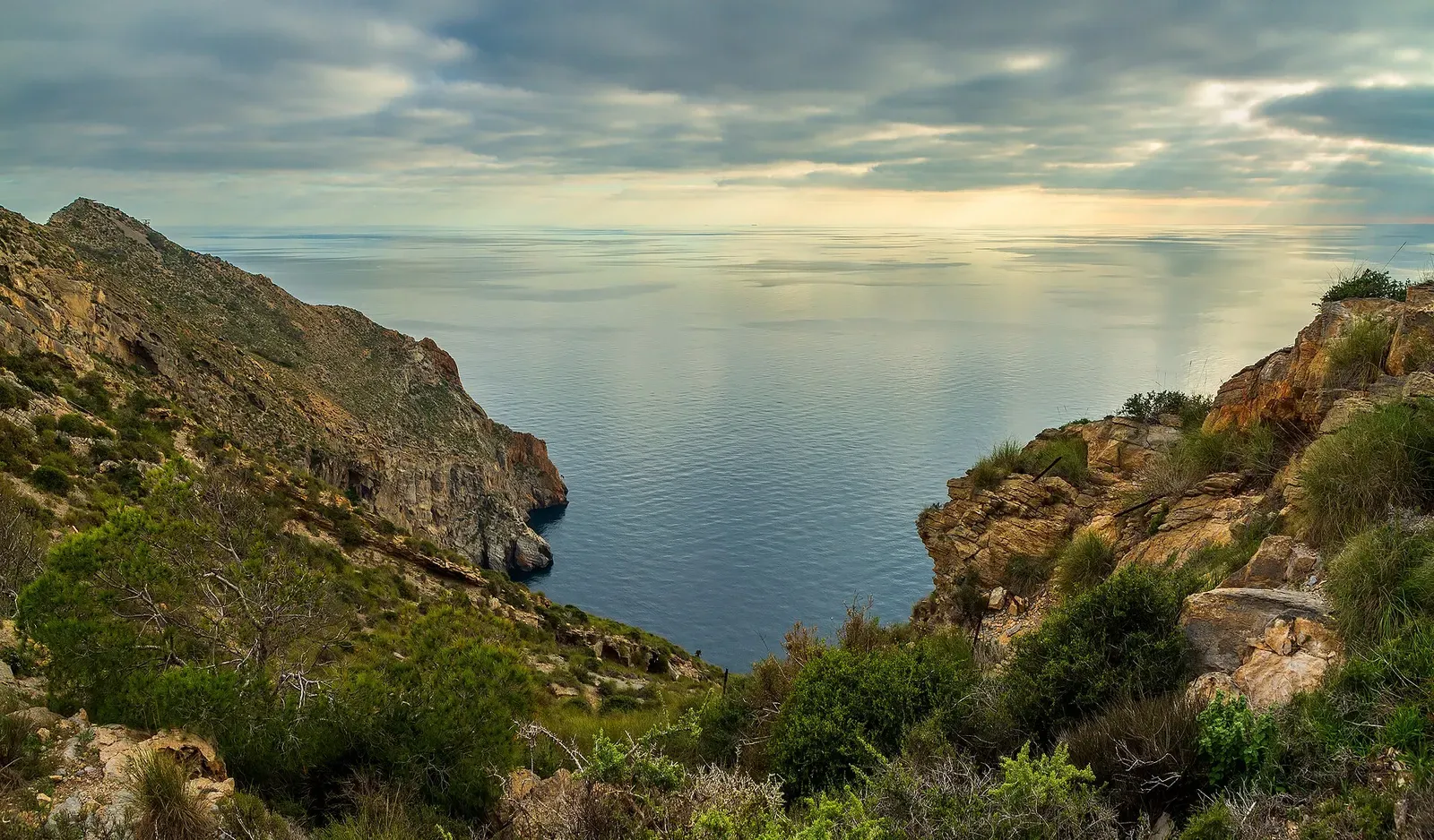
A zoned 2016 marine reserve, a sunk minesweeper and a 3 km hypogenic cave

A hot spring vents into the sea off Karaada's caves

Granite seamounts rising to the surface off Sardinia's south-east corner


A sunken DC-3 and a replica Bronze Age ship on the Lycian coast