
Coral Triangle · Indonesia
Banda Islands
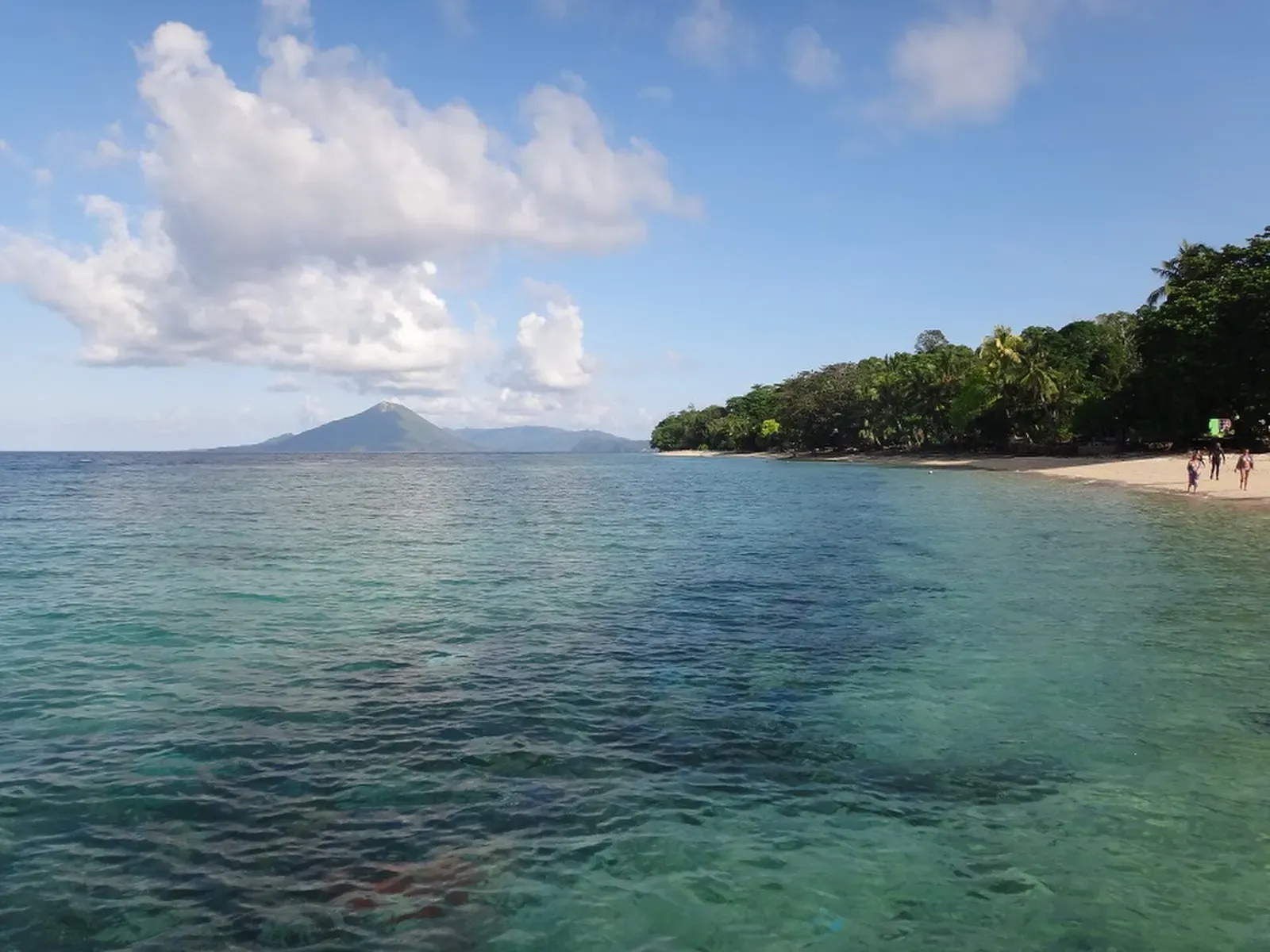
Seamounts off a still-active volcano occasionally draw hammerheads into open water.
Photo: WiDi · CC BY-SA 4.0
The Banda Islands, a remote volcanic archipelago in Indonesia's Banda Sea, were once the world's only source of nutmeg and remain reachable mainly by liveaboard on transit routes between Raja Ampat and Komodo. Steep walls plunge into deep water around Gunung Api, an active volcano, and nearby seamounts occasionally draw hammerhead sharks and mobula rays into open water. Coral cover is exceptionally intact due to low visitor numbers and the area's remoteness.
About diving in Banda Islands
Getting there shapes everything about the trip. Itineraries cross open water to reach the group, so dive days sit between long overnight steams and the schedule carries no slack. Once the boat is anchored off Bandaneira the pace loosens considerably: sites are minutes apart, several drop straight off the islands, and there is time ashore between dives. The Dutch-era forts above the harbour and the old town below them are part of why divers pick this route over a straighter crossing.
The diving falls into three shapes. Island and channel walls drop into deep water with no shelf below to catch a diver, and the flow accelerates where the islands narrow the gap between them. Offshore, isolated pinnacles rise out of open ocean, and those dives are spent as much in blue water as on structure. The slopes under the volcano are a third case again, where coral has grown over bare lava left by its last major eruption rather than over old layered reef, which tends to show in the even age and spacing of the colonies.
The pinnacle dives set the tone of the week. Boats often schedule them early in the day, brief them as a drift with a regrouping plan, and expect the group to be spread over a lot of water by the end. The routine is a negative entry, a quick descent to get under the current, then time held on the up-current side watching open water while the reef itself carries the dive when nothing passes. Surface markers and a crew that tracks bubbles matter more here than on sheltered sites.
It suits experienced divers who are self-sufficient in current, comfortable with the lack of reference in blue water, and willing to trade long transits for reefs that see very few boats in a season. Evacuation and chamber facilities are a long way off, so conservative profiles, valid dive insurance and honest self-assessment count for more than they would closer to home. October and November rate highest, September and the March-to-May shoulder are workable, and mid-year crossings still run in less settled seas.
Best time to dive Banda Islands
| Jan | Feb | Mar | Apr | May | Jun | Jul | Aug | Sep | Oct | Nov | Dec | |
|---|---|---|---|---|---|---|---|---|---|---|---|---|
| Season | Fair | Fair | Good | Good | Good | Fair | Fair | Fair | Good | Prime | Prime | Fair |
| Sea surface | 30°C86°F | 29°C84°F | 29°C84°F | 30°C86°F | 29°C84°F | 28°C82°F | 27°C81°F | 27°C81°F | 27°C81°F | 28°C82°F | 30°C86°F | 30°C86°F |
| Daytime high | 30°C86°F | 30°C86°F | 29°C84°F | 29°C84°F | 29°C84°F | 28°C82°F | 27°C81°F | 27°C81°F | 28°C82°F | 29°C84°F | 30°C86°F | 30°C86°F |
| Rain | 195 mm7.7 in | 149 mm5.9 in | 179 mm7.0 in | 186 mm7.3 in | 248 mm9.8 in | 199 mm7.8 in | 161 mm6.3 in | 68 mm2.7 in | 77 mm3.0 in | 72 mm2.8 in | 81 mm3.2 in | 166 mm6.5 in |
| Jan | Feb | Mar | Apr | May | Jun |
|---|---|---|---|---|---|
| Fair | Fair | Good | Good | Good | Fair |
| Sea surface | |||||
| 30°C86°F | 29°C84°F | 29°C84°F | 30°C86°F | 29°C84°F | 28°C82°F |
| Daytime high | |||||
| 30°C86°F | 30°C86°F | 29°C84°F | 29°C84°F | 29°C84°F | 28°C82°F |
| Rain | |||||
| 195 mm7.7 in | 149 mm5.9 in | 179 mm7.0 in | 186 mm7.3 in | 248 mm9.8 in | 199 mm7.8 in |
| Jul | Aug | Sep | Oct | Nov | Dec |
|---|---|---|---|---|---|
| Fair | Fair | Good | Prime | Prime | Fair |
| Sea surface | |||||
| 27°C81°F | 27°C81°F | 27°C81°F | 28°C82°F | 30°C86°F | 30°C86°F |
| Daytime high | |||||
| 27°C81°F | 27°C81°F | 28°C82°F | 29°C84°F | 30°C86°F | 30°C86°F |
| Rain | |||||
| 161 mm6.3 in | 68 mm2.7 in | 77 mm3.0 in | 72 mm2.8 in | 81 mm3.2 in | 166 mm6.5 in |
2011–2025 averages. Sea surface: NOAA Coral Reef Watch, measured at the surface, so deeper water can run colder. Daytime high and rain: NASA POWER.
October–April is the main liveaboard transit season; hammerhead and mobula sightings at seamounts are seasonal, not guaranteed.
Best months: October, November
Banda Islands water temperature and weather by month
The sea surface runs from 27 °C (81 °F) in August to 30 °C (86 °F) in December. Most rain falls from December to July, peaking at about 250 mm (9.8 in) in May; it stays largely dry from August to November. Daytime highs sit around 29 °C (84 °F) all year. The coldest water here is about 26 °C (79 °F), so pack a 3 mm full suit.
Dive types & marine life
Walls hold dense hard coral, reef sharks, napoleon wrasse and eagle rays. The offshore pinnacles are dived for hammerheads and mobula rays, though neither is dependable on a given trip; October and November and the March-to-May shoulder are when boats work them most, and mid-year itineraries still run in rougher seas.
- Wall
- Seamount
- Pelagic & blue water
- Reef
- Hammerheads
- Reef sharks
- Napoleon wrasse
- Pristine corals
- Mobula rays
- Eagle rays
Best dive sites in Banda Islands
Wall
Scorpionfish, blackspotted morays and orang-utan crabs on the face.
Pinnacle
Big pelagics turn up on the pinnacles when the current runs.
Wall
A wide step at 30 m before the wall falls away again.
Seamount
Fusiliers roll down the slope thick enough to block the view.
Hard coral grown over lava that reached the sea in 1988.
Wall
A gorgonian-hung wall off the island that nutmeg made famous.
Wall
A 6 m almond-shaped swim-through at 26-30 metres.
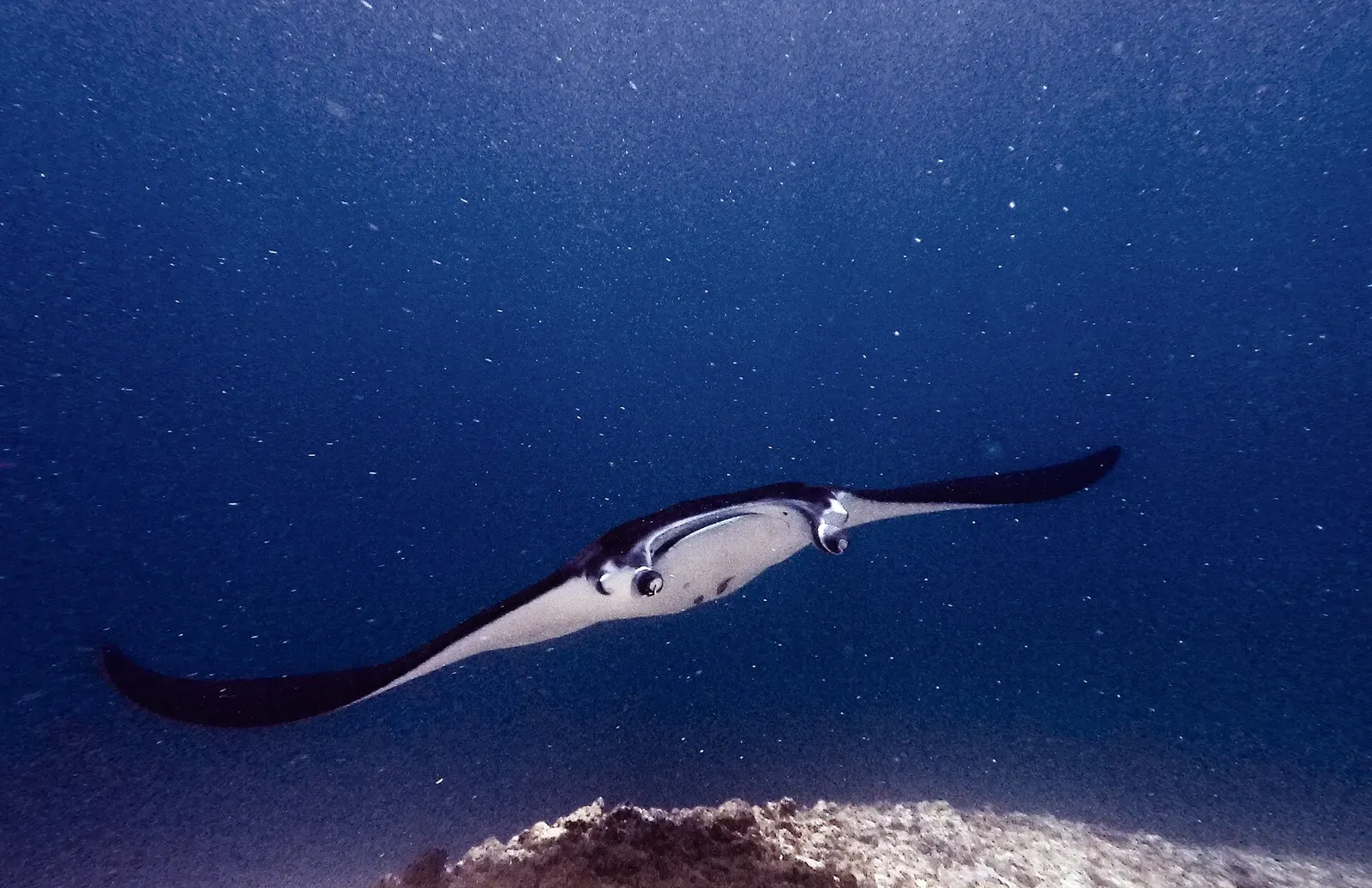
Mobula rays pass in formations up to 25 strong.
Wall
Giant, honeycomb and snowflake morays in one small islet's wall.
Sonegat
Narrow channel wall dive with strong current and reef sharks.
How to get to Banda Islands
Nearly all divers arrive by liveaboard on Banda Sea routes that start or finish in Ambon and link onward to Raja Ampat at one end or Komodo and the Flores ports at the other. Bandaneira has a small airstrip and a ferry link to Ambon, but flights and sailings are intermittent and land-based diving is limited, so in practice the boat sets the itinerary.
Photos from Banda Islands
WiDi · CC BY-SA 4.0
Dive videos
Banda Sea Dive Sites | Indonesia | What To Expect To See | 4K HDR | Sony | DJI Mavic 3 | 2022 · Diver's Lens on YouTube
Diving the Banda Sea on the Samambaia in 2022 (4K) · Dive Hard on YouTube
Photo credits
- The cone of Gunung Api volcano rising from the sea, seen across calm water from a nearby beach by WiDi, CC BY-SA 4.0, via Wikimedia Commons
- A sheltered bay of clear turquoise water framed by jungle-covered cliffs at Pulau Pisang by WiDi, CC BY-SA 4.0, via Wikimedia Commons
Embed
Run a dive centre, club or blog? Embed this map of 9 dive sites near Banda Islands on your own page.
In The Logbook
- Where to dive in every month of the yearTrip planning · 14 min read
- When does coral spawn? The moon's calendarBig animals · 10 min read
- What are thermoclines and haloclines?Ocean science · 8 min read
- Malapascua thresher sharks: Monad or Kimud?Big animals · 11 min read
- When and where to dive with hammerheadsBig animals · 16 min read
Similar destinations

The world's second-largest contiguous coral reef, closed to fishing
Drift dives past sharks and tuna on current-swept seamounts
Coral Triangle
Belongas Bay & South Lombok
Indonesia
Schooling scalloped hammerheads on the open-sea pinnacles of Belongas Bay


Whale sharks feed under fishing platforms for one of diving's most reliable encounters.