
Utila is the smallest of the main Bay Islands of Honduras, sitting on the Mesoamerican Barrier Reef with more than 60 dive sites around its shores. It certifies more new divers than anywhere else in the Caribbean, and most sites are gentle: Jack Neil Point and Seahorse Reef for macro, CJ's Drop-off for a sheer south-side wall. Whale sharks pass the island year-round, and the seamount at Black Hills is where divers watch the blue for them.
About diving in Utila
Most divers explore Utila from land-based dive shops, and at most of them the boats are boarded from a dock rather than a beach; most dive boats take snorkellers along too. Ted's Point can be entered from shore as well as by boat. Surface conditions are generally calm, but the north side, with The Pinnacle seamount and the whale-shark bait balls, is only reached in settled weather spells. A liveaboard is the only practical way to pair Utila with Roatan and the Cayos Cochinos in one week.
Underwater the reef runs from shallow tongue-and-groove spurs and seagrass beds to sheer walls and two seamounts. The shallow, protected reefs hide frogfish, seahorses, jawfish and nudibranchs, and a small barge and a small fishing boat have been sunk on purpose. Barracuda, jacks and turtles cruise the edge of CJ's Drop-off, and eagle rays, grouper and snapper pass in the blue off Raggedy Cay. At Lighthouse Reef, far from the main dive hub, stands of elkhorn and staghorn coral grow beside barrel sponges the size of small cars.
Currents around most sites are mild to non-existent, and even the island's drift dives are gentle one-way finning, so the island suits divers in training. The shallow macro sites suit photographers and patient divers who enjoy a slow hunt for small subjects, though Seahorse Reef holds nothing for big-animal lovers. Depth and current set the limits: the Halliburton Wreck lies at 24–27 m (80–90 ft) with current that can be moderate, so it suits advanced divers or well-supervised beginners with good air consumption.
Best time to dive Utila
| Jan | Feb | Mar | Apr | May | Jun | Jul | Aug | Sep | Oct | Nov | Dec | |
|---|---|---|---|---|---|---|---|---|---|---|---|---|
| Season | Fair | Good | Prime | Prime | Prime | Good | Good | Good | Good | Fair | Fair | Good |
| Sea surface | 27°C81°F | 27°C81°F | 27°C81°F | 28°C82°F | 29°C84°F | 29°C84°F | 29°C84°F | 29°C84°F | 30°C86°F | 30°C86°F | 29°C84°F | 28°C82°F |
| Daytime high | 28°C82°F | 28°C82°F | 31°C88°F | 32°C90°F | 32°C90°F | 31°C88°F | 30°C86°F | 31°C88°F | 31°C88°F | 31°C88°F | 29°C84°F | 28°C82°F |
| Rain | 244 mm9.6 in | 130 mm5.1 in | 111 mm4.4 in | 67 mm2.6 in | 104 mm4.1 in | 197 mm7.8 in | 195 mm7.7 in | 183 mm7.2 in | 203 mm8.0 in | 330 mm13.0 in | 397 mm15.6 in | 270 mm10.6 in |
| Jan | Feb | Mar | Apr | May | Jun |
|---|---|---|---|---|---|
| Fair | Good | Prime | Prime | Prime | Good |
| Sea surface | |||||
| 27°C81°F | 27°C81°F | 27°C81°F | 28°C82°F | 29°C84°F | 29°C84°F |
| Daytime high | |||||
| 28°C82°F | 28°C82°F | 31°C88°F | 32°C90°F | 32°C90°F | 31°C88°F |
| Rain | |||||
| 244 mm9.6 in | 130 mm5.1 in | 111 mm4.4 in | 67 mm2.6 in | 104 mm4.1 in | 197 mm7.8 in |
| Jul | Aug | Sep | Oct | Nov | Dec |
|---|---|---|---|---|---|
| Good | Good | Good | Fair | Fair | Good |
| Sea surface | |||||
| 29°C84°F | 29°C84°F | 30°C86°F | 30°C86°F | 29°C84°F | 28°C82°F |
| Daytime high | |||||
| 30°C86°F | 31°C88°F | 31°C88°F | 31°C88°F | 29°C84°F | 28°C82°F |
| Rain | |||||
| 195 mm7.7 in | 183 mm7.2 in | 203 mm8.0 in | 330 mm13.0 in | 397 mm15.6 in | 270 mm10.6 in |
2011–2025 averages. Sea surface: NOAA Coral Reef Watch, measured at the surface, so deeper water can run colder. Daytime high and rain: NASA POWER.
January and February are the slightly cooler months, when a 5 mm suit replaces the usual 3 mm, and the rainy season that began in October ends in January. Whale-shark encounters become most reliable from February, and March through May is the best stretch of the year: dry, warm and at peak visibility. March to August stays mostly dry and sunny. Hurricane risk peaks in September and October, though the water is clear again from September through November. October and November carry the heaviest rain, with occasional runoff, while the second whale-shark season runs October to December as bait balls form off the north side.
Best months: March, April, May
Utila water temperature and weather by month
The sea surface runs from 27 °C (81 °F) in February to 30 °C (86 °F) in September. Most rain falls from September to January, peaking at about 400 mm (16 in) in November; March to May are the driest. Daytime highs reach 32 °C (90 °F) in April and drop to 28 °C (82 °F) in January. The coldest water here is about 26 °C (79 °F), so pack a 3 mm full suit.
Dive types & marine life
Whale sharks pass close to shore year-round, most reliably from February through April and again from October to December, when bait balls form off the north side. Turtles are abundant at Lighthouse Reef, and eagle rays are common at The Pinnacle.
- Reef
- Wall
- Muck & macro
- Pelagic & blue water
- Wreck
- Night
- Whale sharks
- Sea turtles
- Eagle rays
- Groupers
- Frogfish
- Macro critters
Best dive sites in Utila
- 1
Black Hills
Seamount rising to within 10 m (35 ft), where whale sharks pass in spring and autumn; current can be strong.
- 2
CJ's Drop-off
Vertical south-side wall from a 9 m (30 ft) reef top past 42 m (140 ft), with tube sponges and black coral.
- 3
Duppy Waters
Gently sloping coral garden from 6 to 24 m, with eagle rays and stingrays over the sand; suited to night dives.
- 4
Jack Neil Point
Tongue-and-groove reef to about 12 m (40 ft), with seahorses, flying gurnards and toadfish.
- 5
Raggedy Cay
Reef crest at 7.5 m (25 ft) above a wall to 40 m, with nurse sharks resting on the sand at its base.
- 6
Halliburton Wreck
Small barge sunk as an artificial reef in 1998, now a haven for small, specialised invertebrates.
- 7
Ron's Wreck
Small fishing boat upright in 18 m (60 ft), with frogfish in the wreckage and garden eels on the sand.
- 8
Seahorse Reef
Seagrass and coral heads no deeper than 7.5 m (25 ft), where lined seahorses cling to the vegetation.
Site guides
Wreck
A 2021 light-plane wreck flat on the sand at 24 m
Wall
A large seahorse in the garden eels at 18-24 metres
Seamount
Utila's blue-water seamount, with whale sharks passing over
Wall
A sand channel drift past caverns between wall and slope
Wall
A drop-off dive over one of Utila's coral nurseries
Wall
Near-vertical face of tube sponges, sea fans and black coral
Coral garden
Bioluminescent glow after dark gave this reef its ghost name
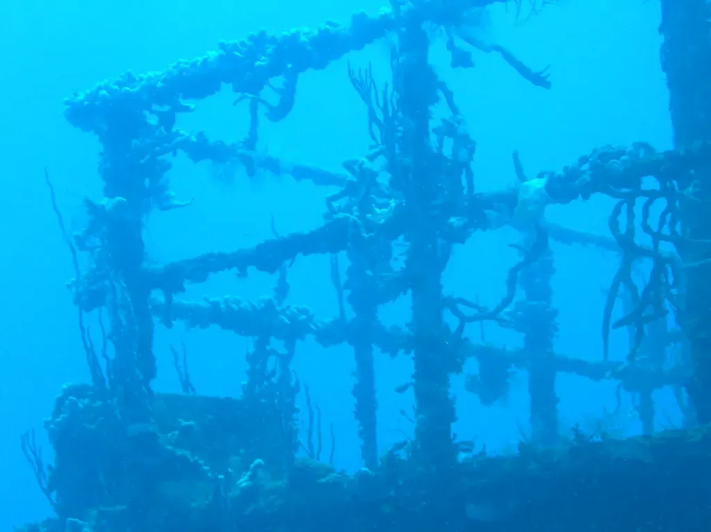
A 1998 artificial-reef wreck dived for its critters
Wall
Swim-throughs and overhangs on a wall to 21 metres
Reef
Hawksbill and green turtles at the reef's western end
Sand slope
A sand break through the reef, beach to past 30 metres
Reef
Broken walls and sand channels, 4.6 to 30 metres
Wall
Turtles and nurse sharks resting on sand at the wall's base
Wreck
An old shrimp boat at 18 metres, full of small life
Reef
Black coral on a south-side drop, marked by four buoys
Wall
A 100-metre crack in the wall at 18 metres
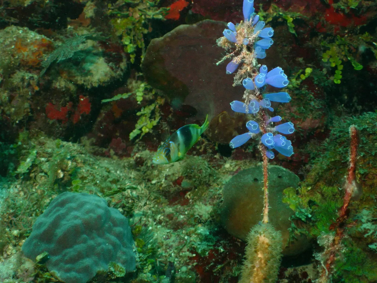
A small sailboat wreck that shelters green morays and nurse sharks
Reef
A maze of reef channels at around 12 metres
Cave & cavern
A cavern mouth at 24 metres, just past The Maze
How to get to Utila
La Ceiba on the Honduran mainland has an international airport (LCE), and the Utila Dream ferry crosses from La Ceiba to the island, which lies 32 km (20 miles) to the northwest. The ferry docks in the main town, which is small enough to walk everywhere.
Photos from Utila
Garner Fun Photos · CC BY 2.0
Garner Fun Photos · CC BY 2.0
Garner Fun Photos · CC BY 2.0
Garner Fun Photos · CC BY 2.0
Dive videos
What Scuba Diving Utila, Honduras ACTUALLY Looks Like · Divemaster Austin on YouTube
Questions divers ask
Is Utila a good place to learn to dive?+
Yes. The island certifies more new divers than anywhere else in the Caribbean, and Jack Neil Point, Duppy Waters and Seahorse Reef are gentle sites suited to beginners; Seahorse Reef is open to snorkellers as well.
Which Utila dive sites need advanced certification?+
Black Hills and The Pinnacle, the two seamounts: at Black Hills the current can be strong at the surface and on the down-current side, and at The Pinnacle it can be strong and unpredictable. The deep faces of CJ's Drop-off and Raggedy Cay are also for advanced divers, though their reef tops suit every level.
What wetsuit is needed for diving in Utila?+
A 3 mm suit is comfortable for most divers year-round. In the slightly cooler months of January and February a 5 mm works well, and some divers skip the wetsuit entirely in summer.
Sources
- Your best guide to scuba diving in Utila with whale sharks in Honduras — Dive The World
- Teds Point dive site — PADI
- Whale Shark Viewing — Utila Guide
- Honduras — Roatan Tourism Bureau
- Útila — Wikivoyage
Photo credits
- Sunlit elkhorn coral rising from a shallow reef near Utila, Honduras. by Lee Cain, CC BY 4.0, via Wikimedia Commons
- A French angelfish swims past a sea fan on a coral reef near Utila. by Garner Fun Photos, CC BY 2.0, via Openverse
- A wide coral reef scene near Utila with sea fans and fish over the reef structure. by Garner Fun Photos, CC BY 2.0, via Openverse
- A queen angelfish in yellow and blue patrols a coral reef near Utila. by Garner Fun Photos, CC BY 2.0, via Openverse
- A school of blue tang graze over coral rubble on a reef near Utila. by Garner Fun Photos, CC BY 2.0, via Openverse
Embed
Run a dive centre, club or blog? Embed this map of 12 dive sites near Utila on your own page.
In The Logbook
- The best wall dives in the worldWalls & drop-offs · 11 min read
- Bioluminescence: why the sea glows at nightNight diving · 7 min read
- Night diving: the best night dives in the worldNight diving · 12 min read
- Why is 1.4 bar the oxygen limit in diving?Body & health · 13 min read
- Gas density: why deep air gets hard to breatheBody & health · 8 min read
- Cheapest places to scuba dive, and the catchTrip planning · 15 min read
- Where to dive with whale sharks, month by monthBig animals · 16 min read
Similar destinations
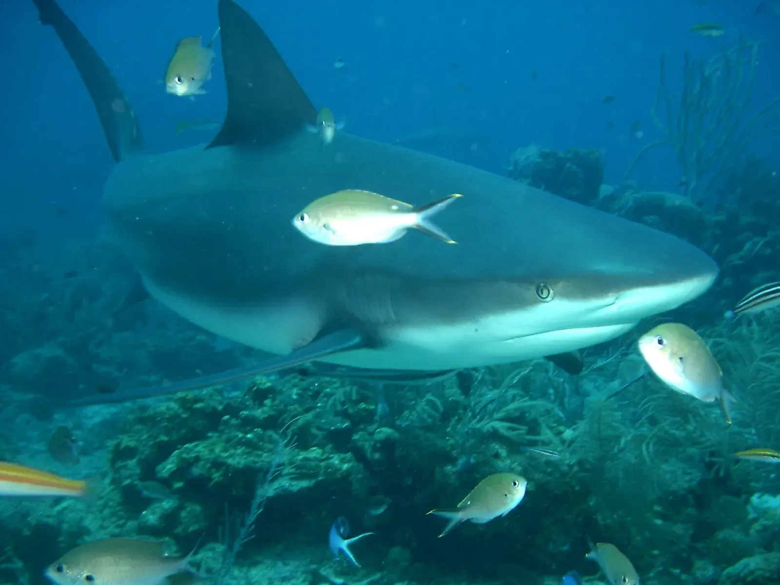
Walk in from a beach resort and be on a coral wall within a five-minute swim

Swim off a beach onto a wall that drops past 900 metres
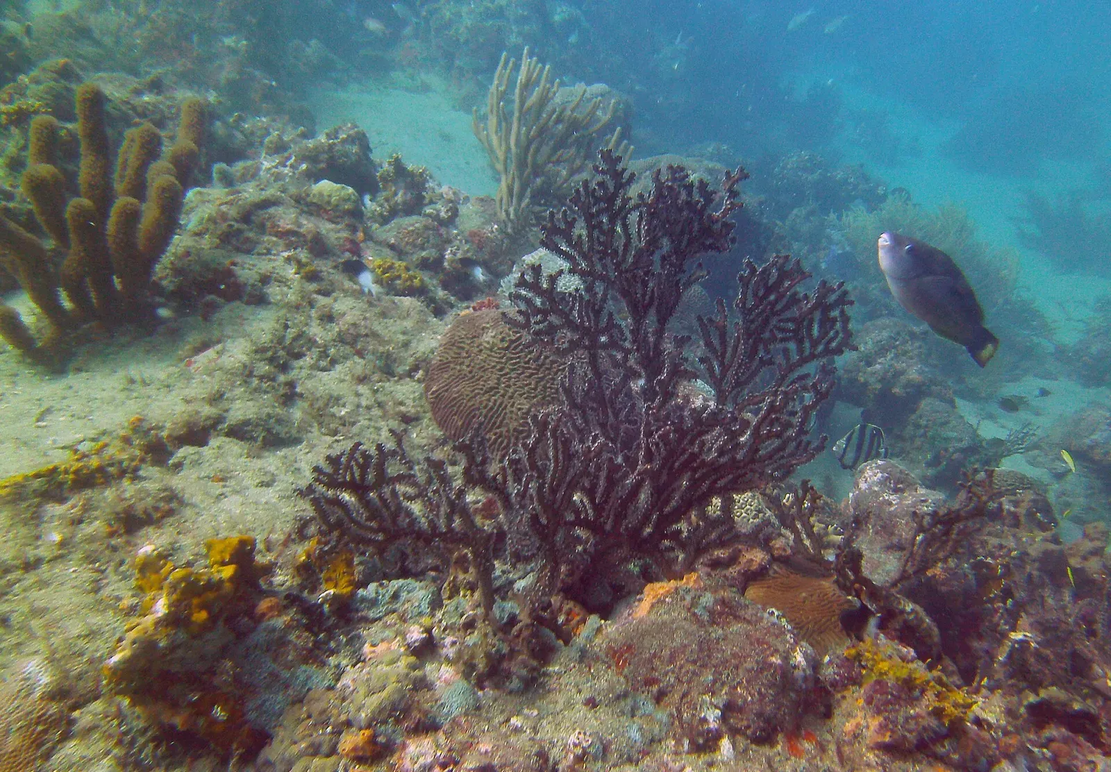
Cold upwelling makes Colombia's Caribbean coast unexpectedly productive


Lava flows, old wreck sites and night turtles in a marine park